Enid, OK Tornado Emergency
The Enid, Oklahoma EF4 tornado is the strongest tornado of 2026 (as of April 24). As it approached the city, radar showed a clearly dangerous tornado, prompting a rare Tornado Emergency for southern Enid. HailTrace's Alexa Robb recaps the storm and the significance of this high-end warning.

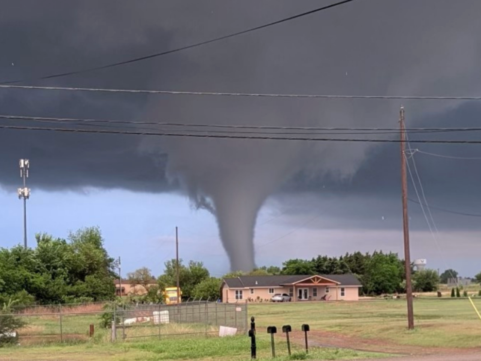
A large and destructive EF4 tornado hit Enid, Oklahoma, on Thursday night, causing widespread damage and multiple injuries.
A Particularly Dangerous Situation
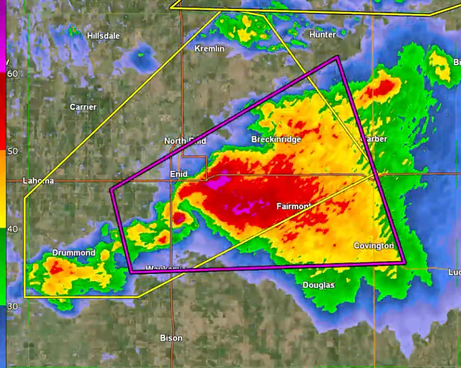
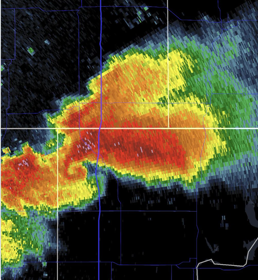
Between approximately 7:55 and 8:00 PM CDT, a supercell thunderstorm over the Enid area began to show significant rotation and a clear hook, signifying tornadogenesis, the formation of a tornado.
Minutes later, the National Weather Service issued a Tornado Warning with a “Particularly Dangerous Situation” (PDS) tag. By 8:21 PM, officials escalated the event to a Tornado Emergency.
4.23.26 Enid, OK tornado footage. Courtesy, Gustavo, Martinez.
A PDS tag is a rare warning enhancement used to emphasize an especially dangerous and potentially life-threatening situation. A Tornado Emergency represents the highest level of severe weather alert issued by the National Weather Service, reserved for confirmed, destructive tornadoes impacting populated areas.
The Barnsdall, Oklahoma Tornado (May 6, 2024) was the last known Tornado Emergency issuance in the state prior to this event.
As a large #tornado tore through Garfield County, Oklahoma, yesterday evening, @NOAA's #GOESEast tracked the parent #supercell thunderstorm as it grew explosively. The tornado prompted a rare #TornadoEmergency from @NWSNorman. #EnidTornado #OKwx pic.twitter.com/ancVrLOp9r
— NOAA Satellites (@NOAASatellites) April 24, 2026
Time lapse of Enid, OK storm from NOAA satellite. Courtesy, NOAA x CIRA.
These types of emergency declarations are generally associated with long-track, significant tornadoes, including historic events such as the 2013 Moore, Oklahoma Tornado and the 2011 Tuscaloosa–Birmingham Tornado.
Damage Reports Emerging
Aerial view of Enid, OK Tornado-confirmed storm. Courtesy, Ben Levine.
Widespread Attention Overnight
For many across Oklahoma and nationwide, Thursday night’s storm was a stark reminder of the region’s vulnerability to severe weather. The tornado tracked through Enid very slowly (15-20 mph) and while only traveling about 9 miles, remained on the ground for an extended period of time, drawing widespread attention as it was tracked live during severe weather coverage.
Authorities and emergency crews are continuing damage assessments and search operations as recovery efforts begin. HailTrace meteorologists analyzed data consistent with an EF3 tornado rating, but after more information emerged, upgraded to an EF4 Thursday night.
The Enid, Oklahoma EF4 tornado is the strongest tornado of 2026 (as of April 24th, 2026).
16 other tornadoes touched down on Thursday, as well as over 100 reports of hail. All are mapped at HailTrace.com. Check out the website or request a demo to see how HailTrace will help you move faster after a storm.