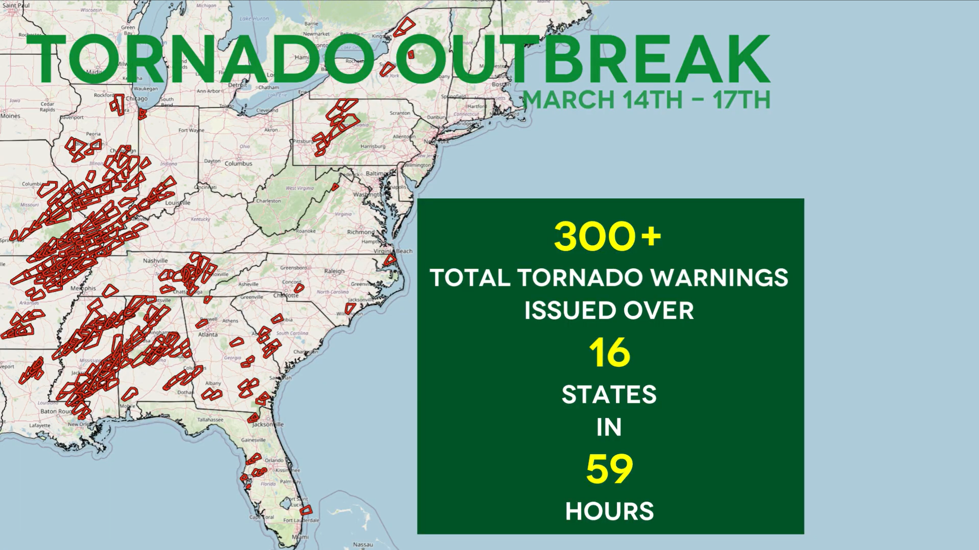
Severe Weather Recap: The March 14th-16th, 2025 Outbreak
From March 14th through March 16th, 2025, a powerful storm system moved eastward across the nation, bringing large hail, high winds, and violent tornadoes.

Following the three-day stretch of storm activity that swept the nation this past weekend, it is safe to say that spring is in full swing.
In a callback to March 14th of last year, March 14th-16th of this year saw widespread severe weather, from as far south as central Texas and the Florida peninsula all the way up to northern Wisconsin and northern New York.
But unlike March 14th, 2024, the storms of this past weekend divided up over multiple days, prolonging the storm risk for those in its path.
A Fast-Moving System
The force behind the March 14th-16th outbreak was a powerful trough crossing eastward over the United States. The very low pressure at the center of this system spurred high environmental wind speeds, sending every storm that developed racing across the risk area.
Although the speed of the thunderstorms made them difficult to keep up with, the Storm Prediction Center (SPC) ended up issuing over 650 severe thunderstorm warnings, most of which indicated the potential for severe wind gusts.

On top of the severe thunderstorm warnings, the SPC released over 300 tornado warnings during the three-day outbreak.
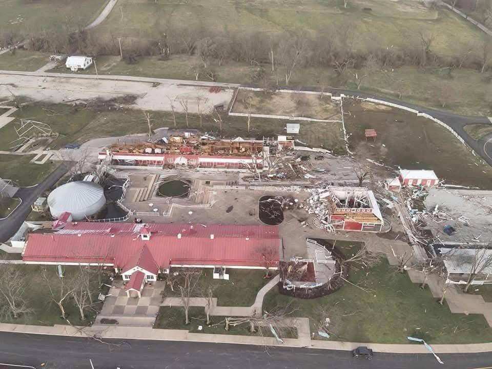
Multiple Violent Tornadoes
Although severe wind gusts covered the most area over the weekend, one of the most striking facets of this storm system were the tornadoes it generated as the line of storms moved eastward.
On the 14th, the St. Louis metro saw multiple EF-2 tornadoes, including one that crossed over the St. Louis Lambert International Airport. Further south, several EF-3 tornadoes as well as two EF-4 tornadoes spawned near the Missouri/Arkansas border.
Tornadic activity moved to the Southeast for March 15th, with an EF-3 tornado and an EF-4 tornado occurring simultaneously near Tylertown, MS.
By the 16th, tornadic activity became significantly less intense as the storm activity migrated into the Northeast. Nevertheless, the Pittsburgh area saw five EF-1 tornadoes, which occurred in conjunction with a broad swath of severe winds.
The First 5-Star of 2025
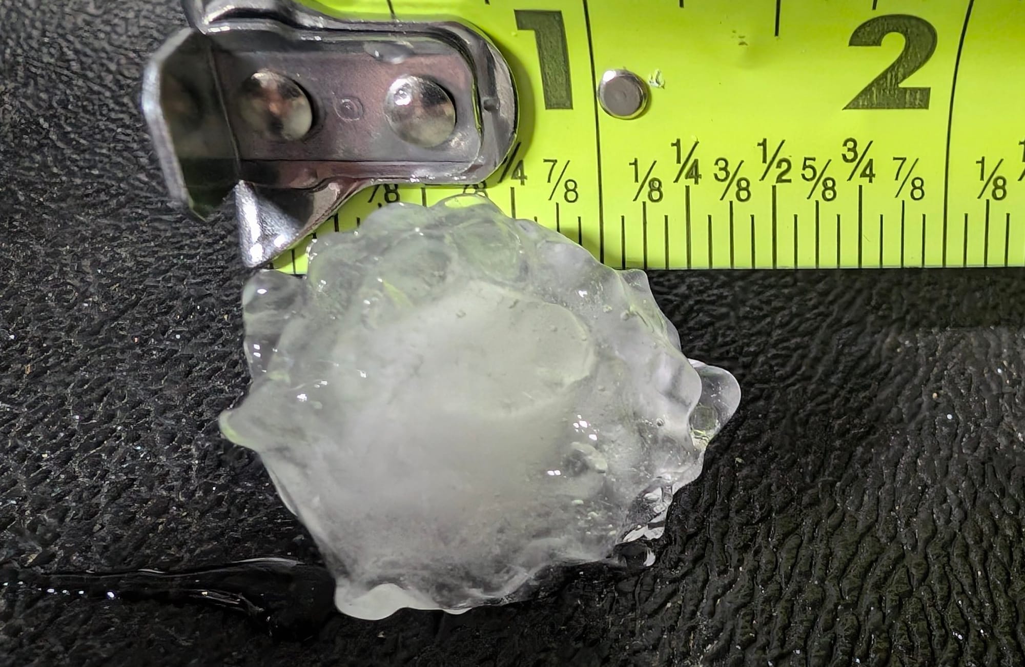
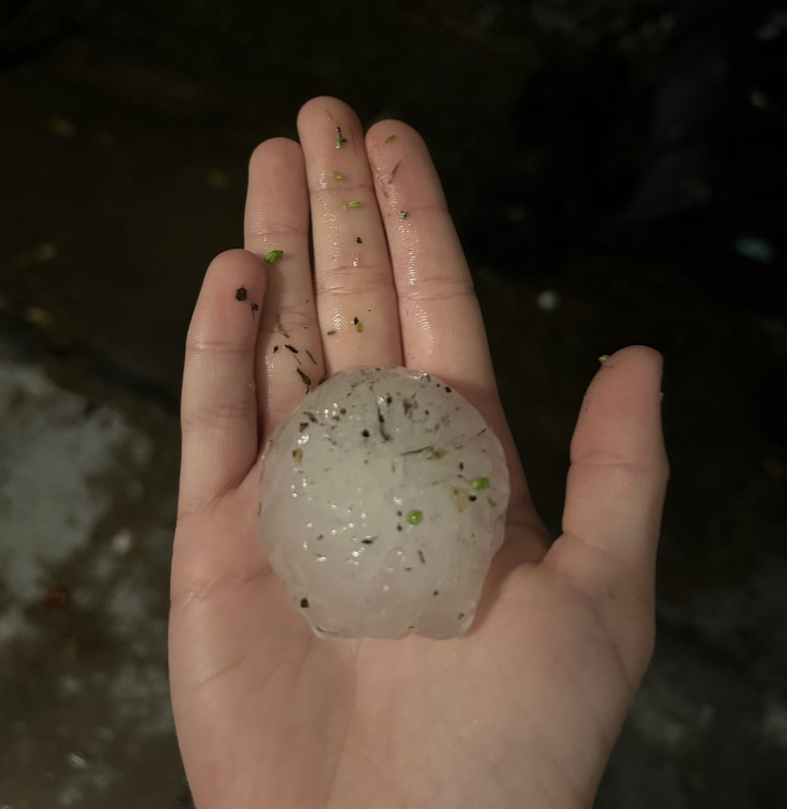
The weekend outbreak saw not one but three 4-Star hail events, in addition to the first 5-star hail event of the year!
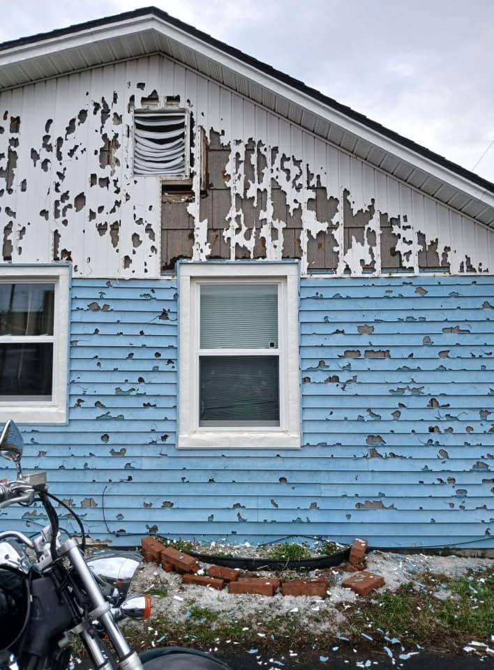
This year's first 5-Star hail event brought wind driven baseball-sized hail to Owensboro, KY, and wind-driven 2" hail to both Jeffersonville, IN, and Louisville, KY. Over 255,000 structures were impacted by severe hail in this event, with over 114,000 structures receiving hail of larger than 1.75" in diameter.
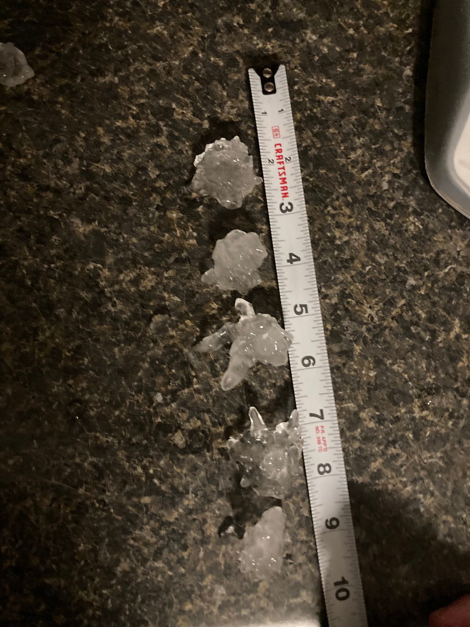
In addition to the 5-Star event in Kentucky and Indiana, there were three total 4-Star events during the weekend outbreak, with each one occurring on a different day of the event.
As part of a series of strong hailstorms that developed in southwestern Missouri and moved northeastward, two long-track hailstorms brought up to 2" hail to the south side of St. Louis, MO. Hail continued to fall as the storms moved into Collinsville and O'Fallon, IL, with well over half a million structures receiving severe hail and larger. This 4-Star event occurred on the evening of March 14th.
In the early morning hours of March 15th, a second 4-Star event occurred in College Station, TX, where up to 2.25" hail fell in the city's downtown, including at Texas A&M University. Over 6,300 structures received hail larger than golf ball size.
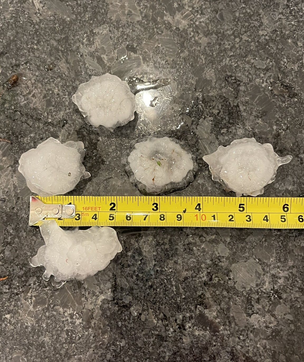
March 16th brought the third and final 4-Star hail event, which occurred in Greensboro, NC, in the evening. During this storm, over 31,000 structures saw golf ball-size hail or larger, with some hailstones reaching up to 2.5" in diameter.
Take a look at HailChatter Episode 4, for a breakdown of some of the biggest hailstorms of the March 14th - 16th outbreak.
HailChatter Podcast "March Holds Nothing Back" on YouTube
The Weekend That Wouldn't Quit
Following the extreme weather of this past weekend, reports came out of at least 42 people who had died due to the variety of hazards associated with this storm system. Because of how fast the storms were moving, severe winds were a common threat across the nation. Moreover, the tornadoes that developed tended to very strong and long-lived.
In addition to the severe hazards, there were also reports of wildfires, stoked by the high winds and dry air that followed behind the storm system. By the night of March 14th, Oklahoma alone had reported up to 130 individual wildfires.
The severe outbreak of March 14th-16th is an important reminder of the dangers associated with the spring storm season, especially with another round of storms on the horizon for this Sunday.
As we advance farther into storm season, HailTrace's team of meteorologists are keeping careful watch for severe hazards all across the nation. Our hail, wind, and tornado maps are a critical resource for identifying when and where severe weather occurs.
You can find HailTrace's range of hail, wind, and tornado maps on our website, HailTrace.com.
To read more about the variety of tools HailTrace offers, check out our blog post on our 4 types of weather reports.