March 14th, 2024: Busiest Hail Day Ever!
March 14th, 2024, was the busiest hail day on record, with giant hail, strong tornadoes, and impacts all the way from Texas to Pennsylvania.

March 14th, 2025, marks one year since the largest hail event on record stormed across the United States. On this first anniversary, taking a look back at the impressive severe weather on March 14th offers an excellent reminder of what the 2025 spring season could bring.
Everything Everywhere All at Once
Although the overall storm threat for March 14th, 2024, was only a level 3 out of 5 on the risk scale, the areal extent of the forecasted activity was very large. Conditions were ripe for strong severe weather from as far southwest as Central Texas to as far northeast as the Ohio/Pennsylvania border.
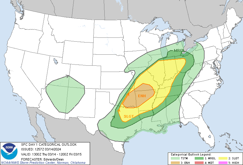
Dallas-Fort Worth, Tulsa, Little Rock, St. Louis, Memphis, and Indianapolis all shared the same potential for severe hazards, with threats of large hail, high winds, and tornadoes concentrated around eastern Oklahoma and the northwestern half of Arkansas.
When storms developed, they produced severe hail, wind, and tornadoes along a northeastward path through the Southern Plains and the Midwest, reaching from south of San Angelo, TX, all the way up to north of Pittsburgh, PA.
An additional cluster of storms broke out over northern Mississippi and Alabama and southern Tennessee. In total, severe weather occurred in 12 states across the US.
Giant Hail in Oklahoma, Tornadoes in the Midwest
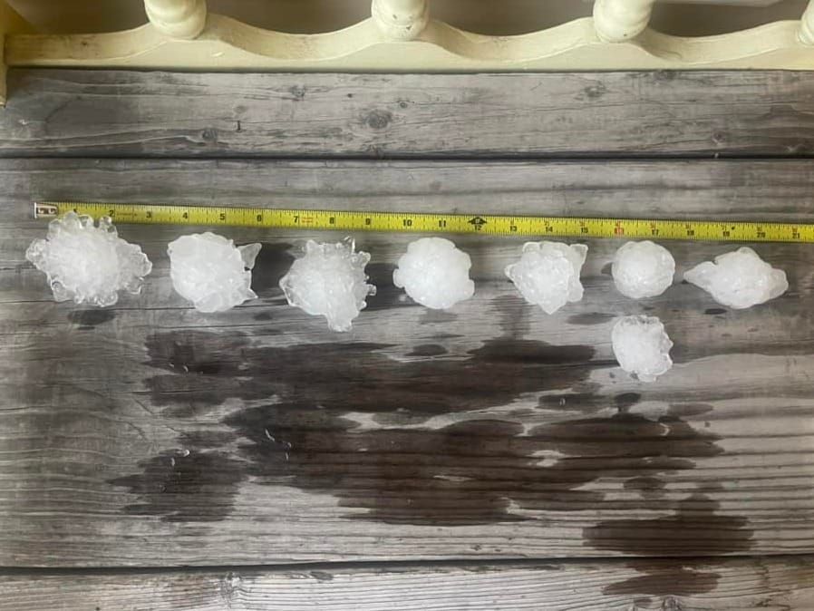
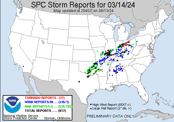
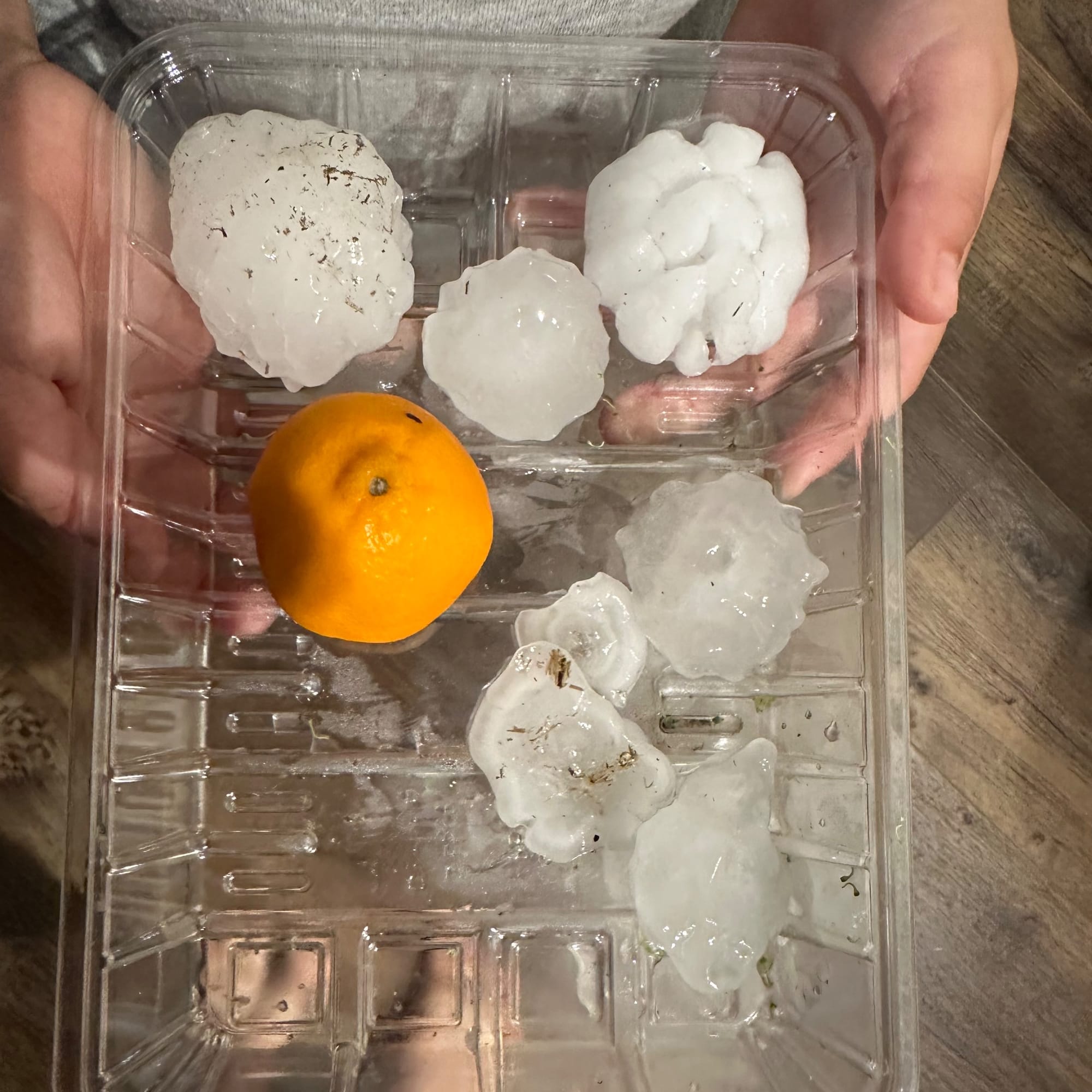
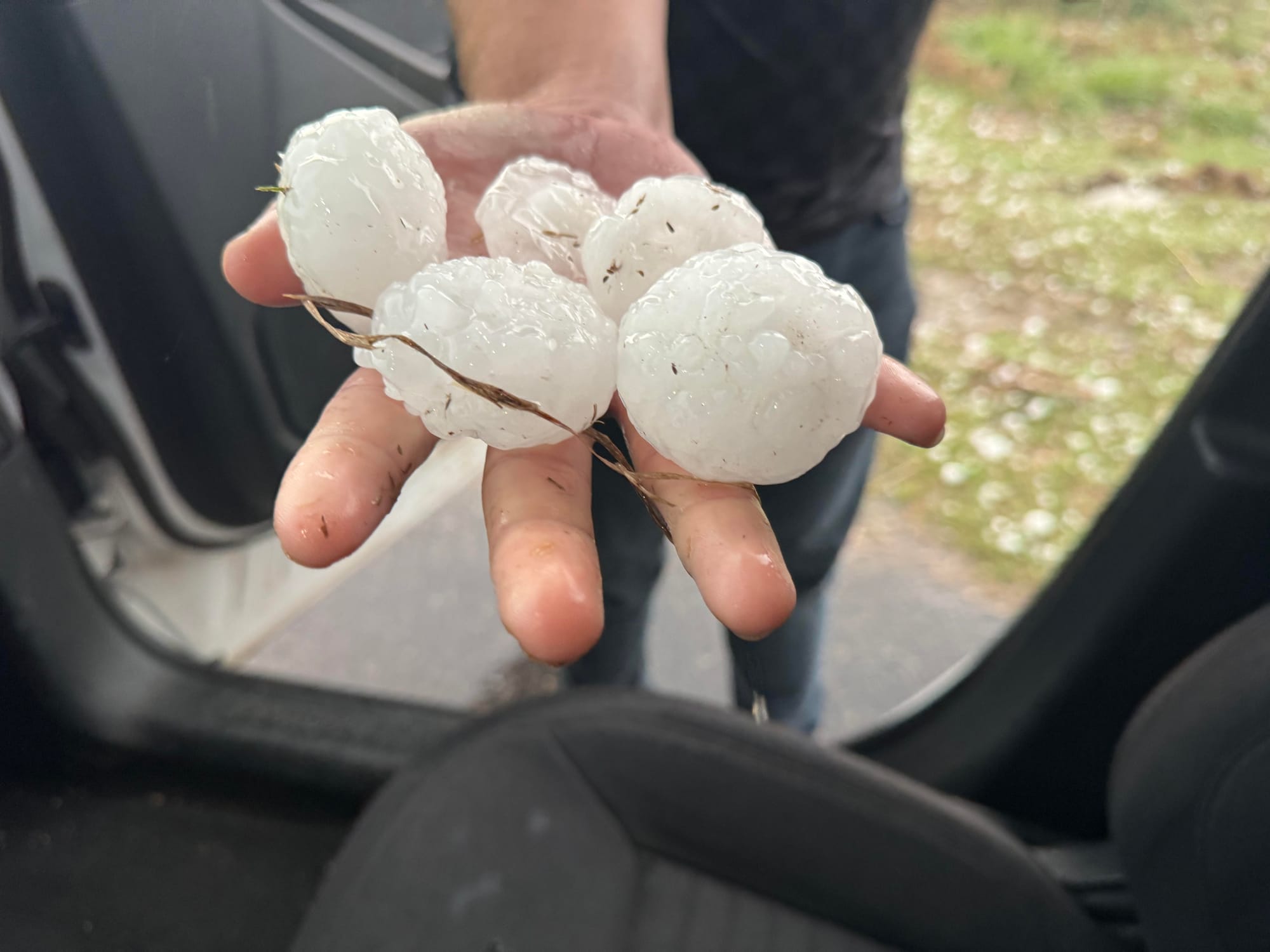
In total, there were 535 public reports of hail across the United States on March 14th. Of these, the largest was a report of 5.25" hail in Ada, OK. Nearly the entire town of Ada received baseball-sized hail or larger, as a severe thunderstorm tracked eastward.

In other locations, including near Bentonville, AR, and eastern Missouri, multiple storms produced hail as large as 4" in diameter.

In addition to the reports of giant hail, there were also 37 reports of tornadoes on March 14th, including two confirmed EF-3 tornadoes in eastern Indiana and western Ohio.
Multiple Metros Impacted
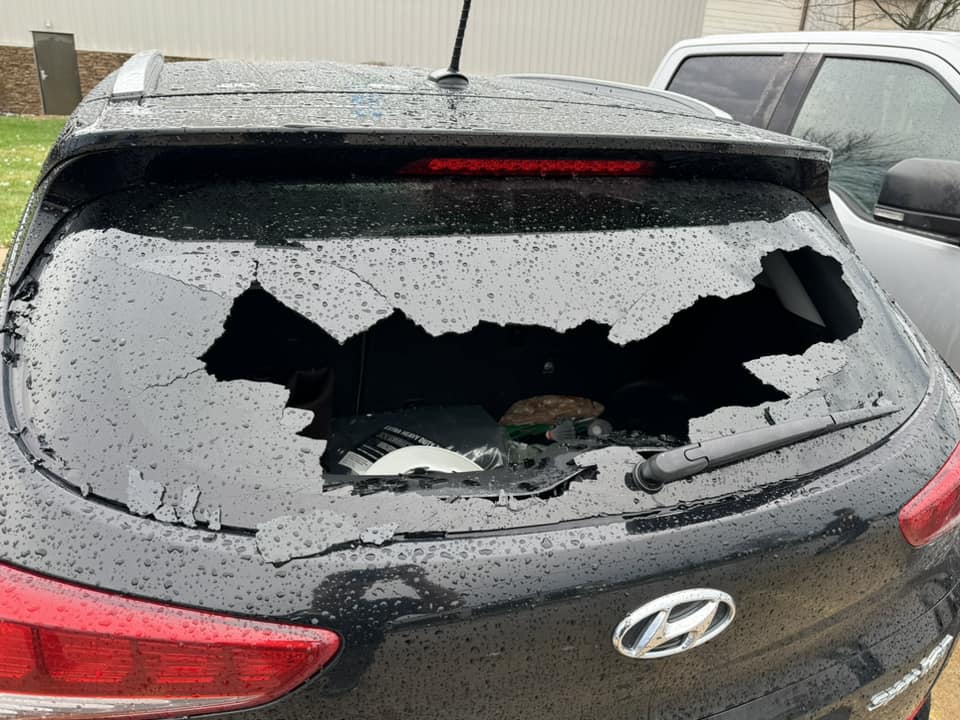
Many of the storms that developed on March 14th were rural; however, both the DFW and St. Louis metros had 5-Star hail events.
Early in the evening, a powerful thunderstorm developed north of Fort Worth, TX, following a northwestward path toward Lewisville Lake. The storm produced hail as large as 3" in diameter, with hail larger than golf ball-size impacting over 51,000 properties across the area, including in Roanoke, Corinth, and Prosper. All told, well over 77,000 structures saw severe hail as this storm crossed over the region.
The story in Missouri was even more impressive.

Similar to the storm in the DFW metro, the storms in the St. Louis metro generally avoided producing any hail downtown. The north and south sides of the city did see up to half-dollar-size hail, but the bigger hail fell farther afield.
One storm over Fenton and Sunset Hills brought up to tennis ball-size hail to over 16,000 structures. An even bigger storm rolled over Warrenton, Wentzville, and O'Fallon, bringing baseball-size hail and larger to nearly 23,000 structures. And across the Mississippi River, a cluster of storms completed the trifecta, bringing hail up to 3.25" to Edwardsville and Glen Carbon, IL. Totaling the impacts of all the March 14th storms in the St. Louis metro, nearly 275,000 structures received severe hail.
In addition to the DFW and St. Louis 5-Stars, there was also one 4-Star map in Oklahoma and Arkansas, including Ada's 5.25" hail, and two 3-Star maps from the eastern US. With 1.25" hail in Fort Smith, AR; 1.5" hail in the Indianapolis suburbs; and 1.75-2" hail in Delaware, OH, and Madison, IN, March 14th made itself known across the nation.
Watch a recap of the top 5 storms of 2024, including March 14th!
March 14th: Round 2?
Despite a slow February, storm activity roared to life this March with a line of severe thunderstorms that churned eastward across the country. With the prospect of another line of storms on March 14th of this year, only time will tell if 2025 is going to try to top the busiest hail day on record.
No matter whether 2025 succeeds or falls short, HailTrace's team of expert meteorologists will be actively monitoring severe weather from before the first hailstone falls. We specialize in identifying weather hazards across the nation, with the aim of supporting those in the restoration industry through real-time hail, wind, and tornado maps.
You can find HailTrace's range of hail, wind, and tornado maps on our website, HailTrace.com.
To read more about the variety of tools HailTrace offers, check out our blog post on our 4 types of weather reports.