Don't Underestimate a Storm Risk... Again!


Mother Nature doesn’t always follow the script. Everyday, the Storm Prediction Center (SPC) outlines areas at risk for severe weather, helping communities prepare for what’s ahead. But sometimes, storms go rogue. One of the wildest examples? June 6, 2018, when a surprise hailstorm hammered the Dallas-Fort Worth metroplex—without any severe thunderstorm risk in place. This billion-dollar event was a stark reminder that even with forecasts, the atmosphere can pull off unexpected moves.
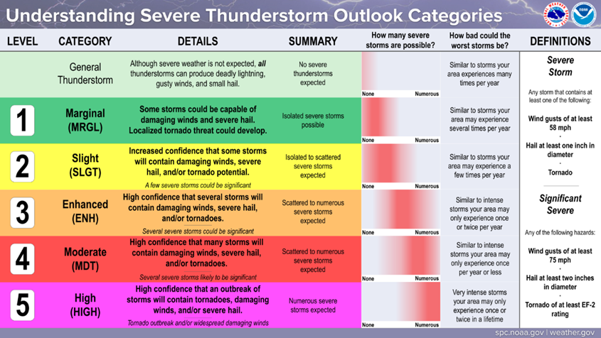
OUTLOOK EXPLANATION
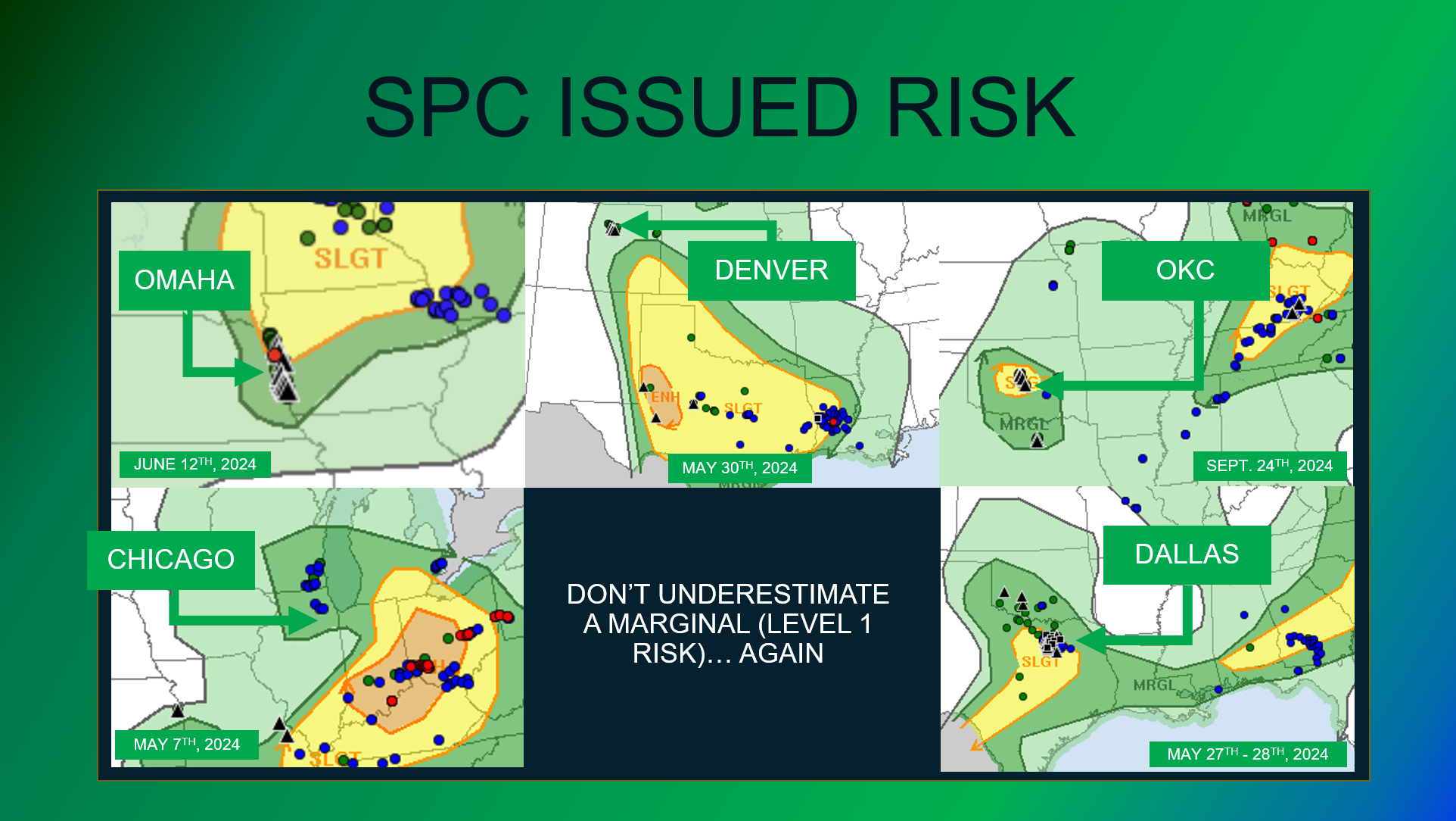
The SPC categorizes its severe thunderstorm risks into multiple categories. They range from Marginal (Level 1; isolated severe storms possible) to High (Level 5; numerous severe storms expected). It's a simple set up, but it often doesn't tell the whole story. A Marginal Risk may verify with 1 storm, but that 1 storm could be wildly impactful if it hits the right areas. HailTrace CEO, Derik Kline likes to say:
IT ONLY TAKES ONE STORM.
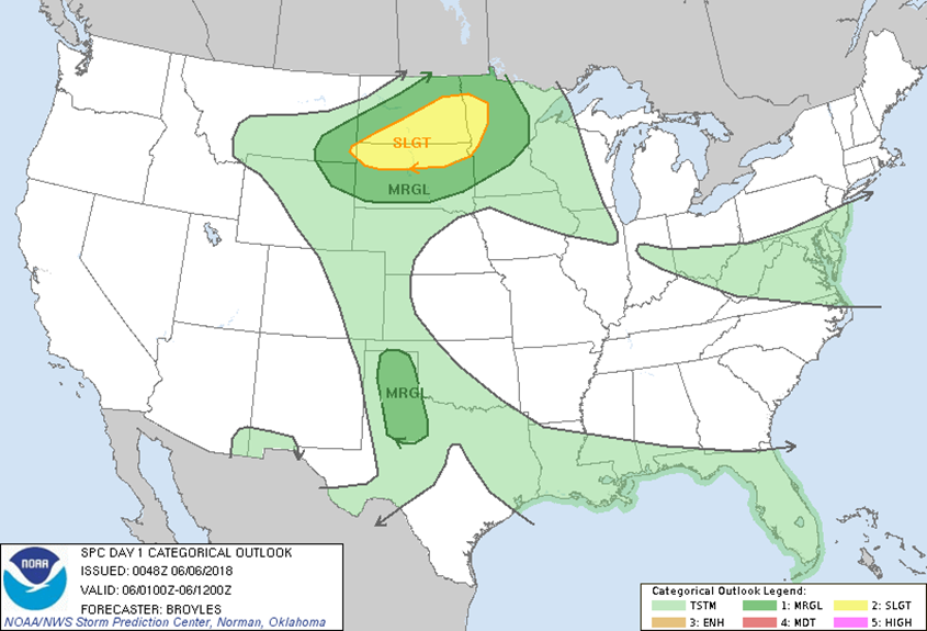
DALLAS FORT WORTH SET UP
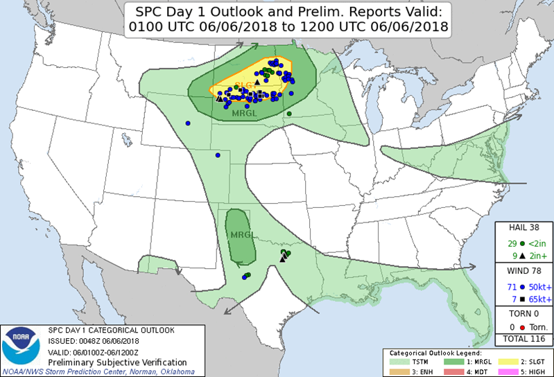
On June 5th, 2018 issued this outlook - outlining the best chance for storms in the Dakotas. Dallas is seemingly in the clear for anything severe. Only general thunderstorms (storms remaining below severe limits) were forecasted for the DFW metro area during this time frame.
WHAT HAPPENED?!
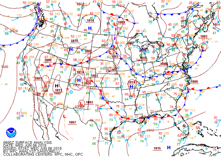
During the overnight hours of June 5, 2018, a weak stationary front was present across northeast Texas, with several disturbances in the northwesterly flow aloft. Although there was instability, moisture, and lift ready to fuel these storms, the evening sounding taken in Fort Worth, TX at 7 PM CDT showed that there was also a cap in place. When a cap is in place, it inhibits storm development. If a cap cannot break, storm development will not occur. The likely reason that DFW was not put in any severe thunderstorm risk was that the Storm Prediction Center did not think there was enough lift to break the cap and produce severe weather.
MOTHER NATURE DECIDED TO BREAK THE CAP
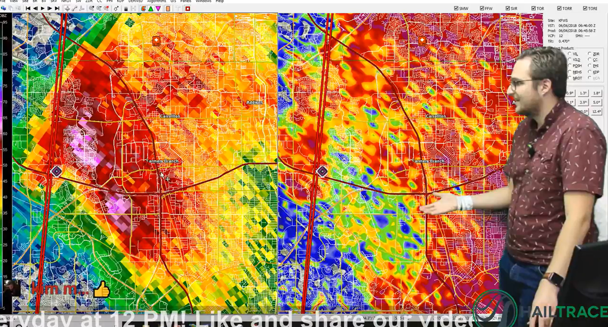
At around Midnight CDT on June 6, 2018, a thunderstorm developed in northwest Collin County, Texas. As the storm slowly moved southward, it gradually intensified. By 12:30 AM CDT, the storm rapidly strengthened. A Severe Thunderstorm Warning was issued at 12:37 AM CDT for 1.00” hail. The storm was over Prosper, TX, moving south. Just before 1 AM CDT, the storm began to split into two separate storms.
The right storm moved into McKinney, producing up to 1.00” hail and eventually weakened, while the left storm continued to rapidly strengthen and moved south-southwest. At 1 AM CDT, the left storm moved into Frisco, producing up to 1.25” hail. It continued south-southwestward, moving along the Denton/Collin County, TX border. A new Severe Thunderstorm Warning was issued at 1:20 AM CDT for 1.00” hail. This warning now included southeast Denton County, southern Collin County, and most of the northern half of Dallas County, TX. The storm began to enter northwest Dallas County, TX at 1:30 AM CDT. In addition, the storm was now producing hail up to 3.00” in diameter according to storm reports in areas such as Carrollton, TX, and Coppell, TX. Another warning had to be issued at 1:41 AM CDT for far western Dallas County and eastern Tarrant County due to the storm beginning to exit the westernmost part of the other warning. Although initially issued for hail up to 1.75” in diameter, the new warning was updated at 1:50 AM CDT for 2.50” hail.
The storm continued moving south-southwest through eastern Tarrant County and western Dallas County, producing very large hail in areas such as Irving, Arlington, and Valley Ranch, until it finally began to dissipate shortly before 3 AM CDT.
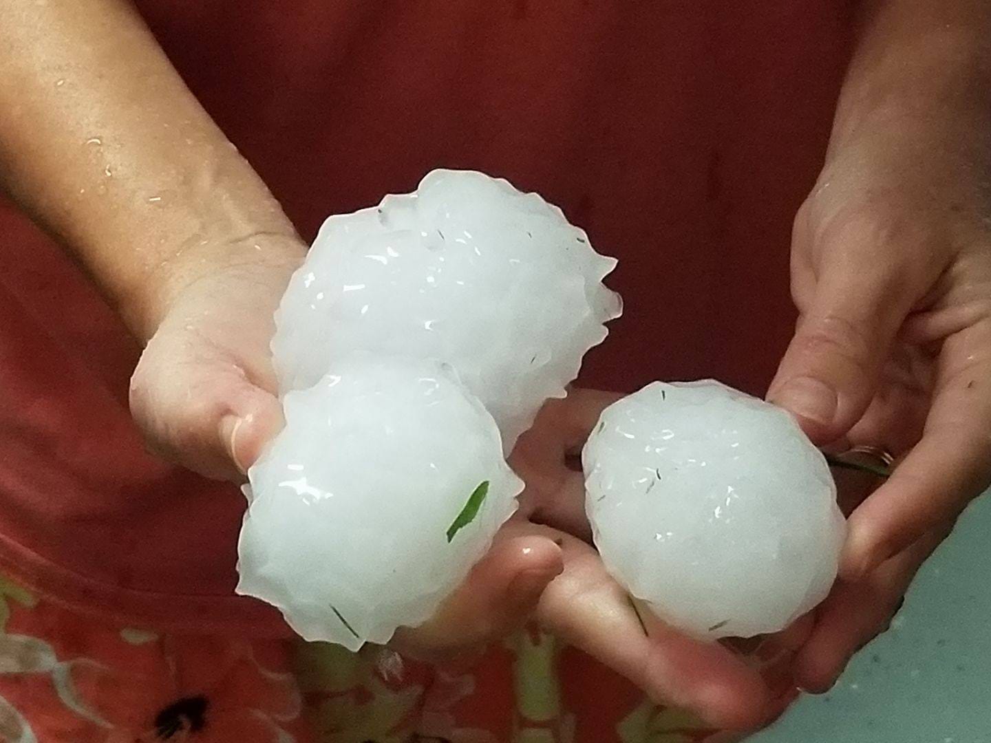
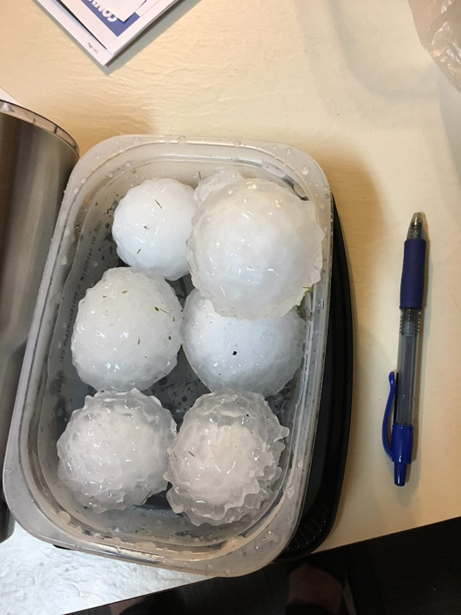
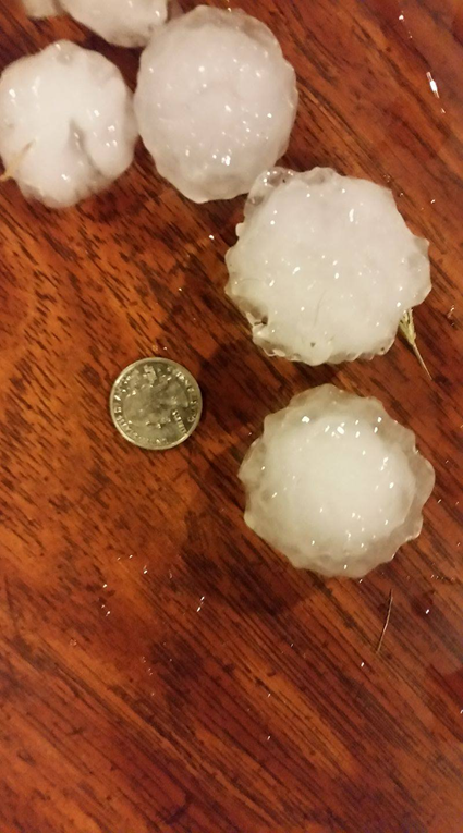
THE AFTERMATH
Although multiple severe thunderstorms developed across the DFW metro area during the early morning hours on June 6, 2018, the Carrollton-Coppell storm stood out. According to the National Centers for Environmental Information, the storms across the DFW metro area caused an estimated $1.6 billion in damage.

Even though there was no severe thunderstorm risk for the DFW metro area, severe thunderstorms did develop and impacted millions! Below is the 8 PM CDT Severe Thunderstorm Outlook from earlier, with the storm reports that were recorded overlaid.
Events like this are why contractors and insurance professionals rely on HailTrace’s live storm tracking—because sometimes the unexpected happens.
Although the conditions did not seem to warrant severe weather, it is important to note that Mother Nature is full of surprises and can sometimes be unpredictable.
HailTrace's team of meteorologists always keeps a close eye out for severe hazards across the country. Our hail, wind, and tornado maps are a critical resource for identifying if, when, and where severe weather occurs.
You can find HailTrace's range of hail, wind, and tornado maps on our website, HailTrace.com.
To read more about the variety of tools HailTrace offers, check out our blog post on our 4 types of weather reports.