The Reason for a Quiet Hurricane Season... So Far
Despite forecasts for a busy season, July’s hurricane activity was quiet, likely due to Saharan dust. August’s still holds promise for more storms as conditions improve.

Before hurricane season officially began, it was making headlines! The National Hurricane Center (NHC) forecasted this season to have more and stronger storms than normal. After Beryl, the Atlantic has been quiet during most of July, the cause for this could be Saharan Dust inhibiting hurricane development.
Off to a Delayed Start
Driven by a La Nina on the horizon and ocean temperatures warmer than average, the NHC forecasted 17 to 25 named storms, 4 to 7 of those becoming major hurricanes. Despite the promise of a busy season, it has been relatively quiet.
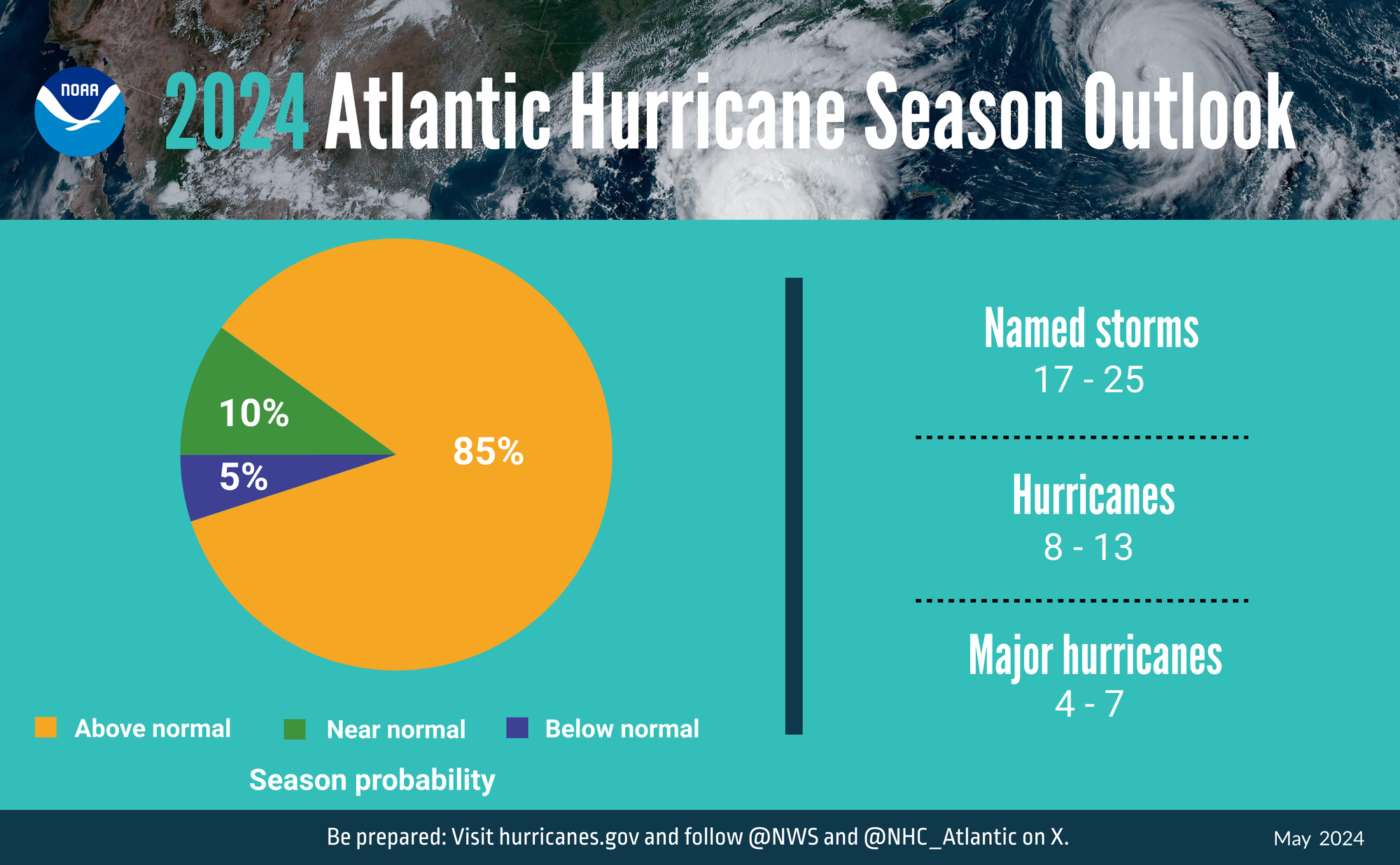
Tropical Storm Alberto set the record for the latest first-named storm in a decade, but Beryl made up for the delayed start by becoming the earliest Category 5 hurricane ever! Since then, there has been a lull in hurricane development.
Could Saharan Dust be at Fault?
Hurricane development begins across the Atlantic Ocean off the coast of Africa. Initially, a major hurricane has humble beginnings as a tropical wave or oceanic disturbance. As it travels west, it will gain strength and could form into a tropical storm or even a hurricane. However, also off the coast of Africa are plumes of Saharan dust, taking the same path as the storm. This dust will inhibit hurricane development.

As the name suggests, this air originates in the Sahara desert, which means it is relatively warm and very dry. Dry desert air is not suitable for a hurricane that needs plenty of moisture for development. The dry layer acts as a cap or lid, more commonly used for spring-time thunderstorms on the plains.
Additionally, Saharan dust causes cooler sea surface temperatures. The layer that the dust travels in is called the Saharan Air Layer or SAL. It is a 2 to 2.5-mile-thick layer of dust about a mile above the ocean. The SAL acts as a filter for sunlight, preventing sea surface temperatures (SST) from warming. Warm SST is pivotal for hurricane development.
What’s next?
A plume of dust has spread out over the US right now, so between the dust and the smoke coming from fires in the west, the sky will be a bit hazy.
Sahara dust forecast shows plumes of dust over the central and southern US, the Caribbean, and off the coast of Africa
Another plume of Saharan dust is on traveling into the Caribbean, and yet third plume just behind that, off the coast of Africa.
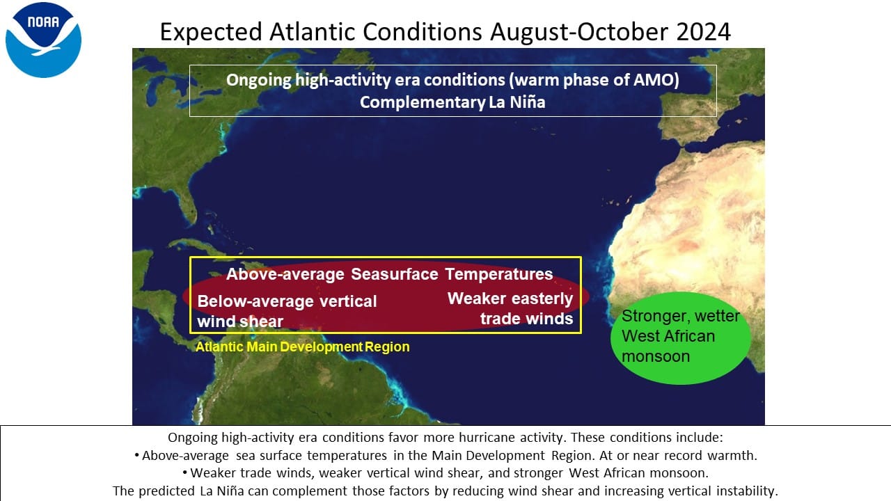
Peak hurricane season is August through October. So a dry July does not mean we couldn't have an active August. In fact, August is expected to have above-average sea surface temperatures and below-average wind shear, both factors promoting hurricane development.
The NHC will issue a new Hurricane Season Outlook in early August. We will be tracking that for you at HailTrace. You can watch our live forecast on Facebook, Youtube, or X.
Now read how A Near Miss at O'Hair: How Tornadoes Can Cause Havoc at an Airport or Why NOAA Hail Reports Aren't Enough to Find Hit Areas.