Radar Down! Creating Accurate Hail Maps During Radar Outages
What happens to your hail mapping software if there’s no radar data?
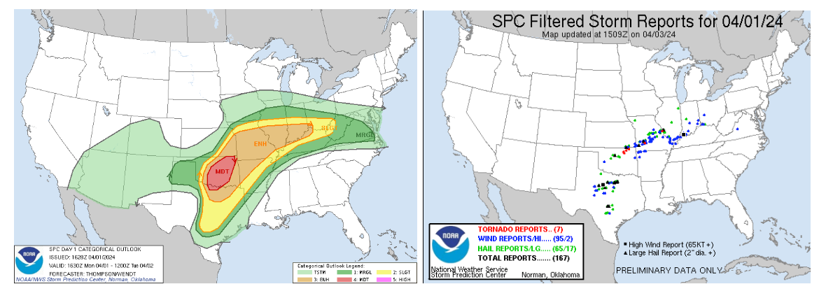
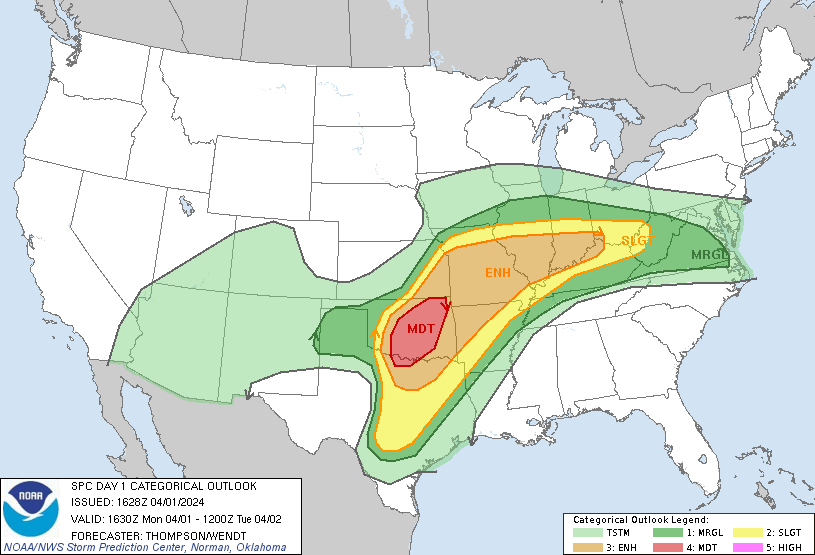
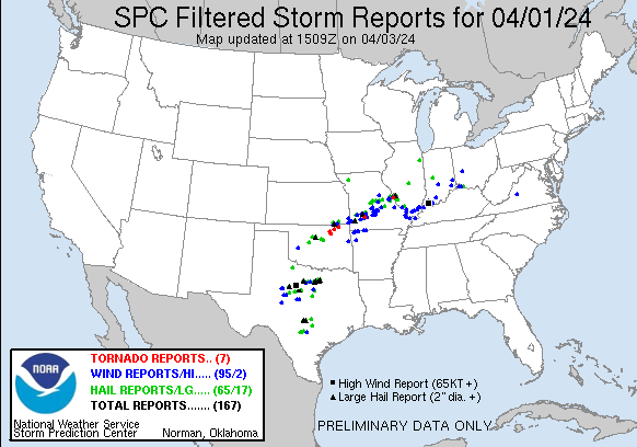
Thankfully, this situation doesn’t happen all that often. But on the early morning of April 2nd of 2024, during one of the most active severe weather days so far this year (see SPC outlook and storm reports, below), networking for the majority of NWS radars experienced a little hiccup.
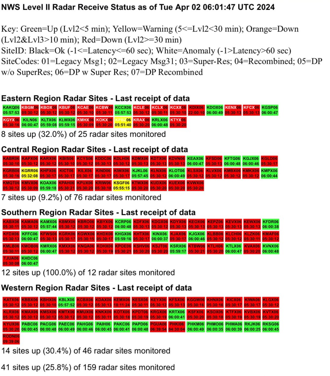
Any radar site shown in red in the graphic below means data was at least 20 minutes old. A number of these radar sites had a radar outage that lasted for an hour or more.
The Impact of a Radar Outage on Hail Mapping Software
This can be a significant problem if your hail mapping software relies on a radar-derived algorithm. Radar data is the primary and in some cases, the only input for these algorithms.
If your algorithm developers are smart, they’ve built in fail-safes that will use radar data from surrounding sites if there is missing data. These fail-safes are crucial because radar outages can happen unexpectedly and for various reasons, such as technical malfunctions, maintenance, or severe weather conditions affecting the radar itself.
During radar outages, the absence of real-time data can significantly impact the accuracy of hail maps. For instance, during a severe thunderstorm, timely radar data is essential to track the storm's development and the potential for hail.
Without this data, the algorithm might not detect the intensity and distribution of hail accurately. This can lead to under-represented hail fall, meaning that areas affected by hail might not be marked correctly on the map, or in some cases, the data could be missing altogether.
What Happens When All Surrounding Radars Are Down?
But again, what happens if all the surrounding radars are also down? Your mapping software is at best going to under-represent the hail fall and at worst, be miss data altogether.
This scenario is rare but not impossible, especially during widespread severe weather events that can cause multiple radar sites to go down simultaneously. In such cases, the redundancy built into the software might not be enough to cover the gaps, leading to significant data loss.
To mitigate these risks, it's essential for hail mapping services to have multiple layers of contingency plans. Combining these various data sources can help fill in the gaps left by radar outages, although each source has its own limitations and uncertainties.
HailTrace’s Approach to Handling Radar Outages
At HailTrace, we rely on our human meteorologists to synthesize data from many different sources. These different sources allow us to:
- Provide a more complete picture of the weather that has occurred.
- Evaluate each dataset against the others to gauge confidence in the source. This is especially helpful when looking at local storm reports.
- Fall back on secondary datasets if there is an outage, like the one that happened on the 2nd.
Our meteorologists are trained to analyze and interpret data from various sources, including weather models, satellite imagery, lightning data, and ground reports. This comprehensive approach allows us to create accurate hail maps even when radar data is incomplete or unavailable. By cross-referencing multiple data points, our team can identify discrepancies and make informed decisions about the most likely hail-hit areas.
The Value of Human Expertise
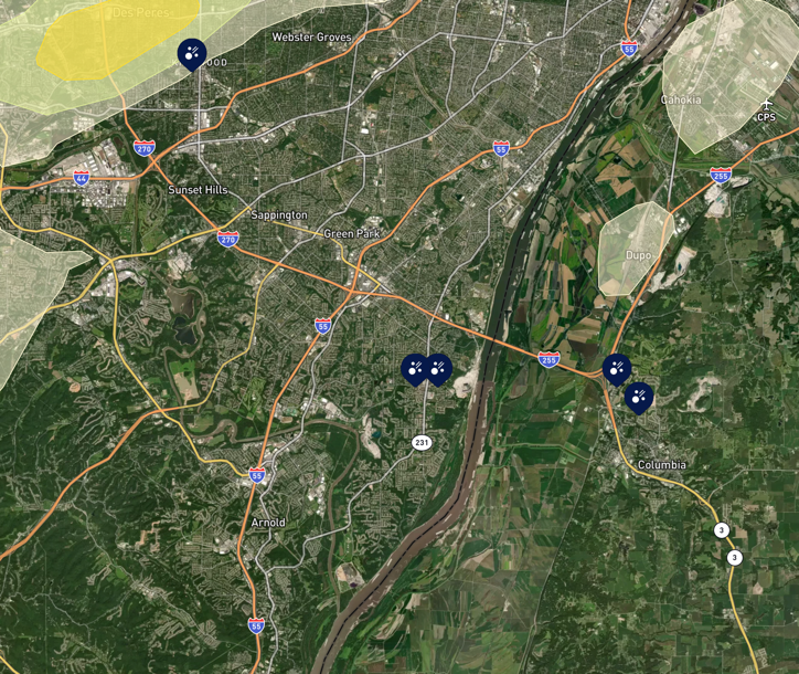
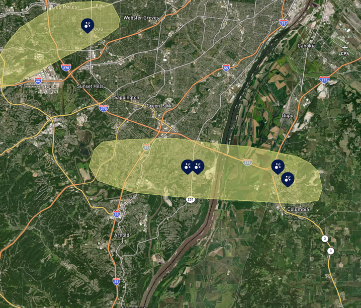
In the HailTrace algorithm (left image), notice the hail reports in and around Columbia, IL, but no hail path due to the radar outage. Our meteorologists (right image) were able to use other data sources to draw paths associated with this storm.
This human intervention ensures that our hail maps remain reliable even when technology fails.
This is one of the greatest values you get when you become a HailTrace client; we have 10 degreed meteorologists on staff. These scientists are instrumental in crafting the best forensic hail products in the industry.
Moreover, our team continuously monitors and updates our hail maps as new data becomes available. This real-time analysis ensures that our clients receive the most up-to-date information, which is crucial for making timely decisions to find areas hit by hail.
It is like having a team of meteorologists in your pocket.
Investing in HailTrace means you are not just relying on automated algorithms but also benefiting from the knowledge and experience of our dedicated team of meteorologists.
We are committed to delivering the highest quality data and insights, even in the face of challenges like radar outages. This commitment to excellence sets HailTrace apart as a leader in the hail mapping industry.
Take a look at our hail maps or request a call to get a subscription today!
Now checkout our previous blog Why NOAA Hail Reports Aren’t Enough to Find Hit Areas.