Inside a Downburst: Science Behind the ‘Rain Bomb’
Intense wind, pelting hail, and heavy rain are all signatures of a downburst - a storm that many have experienced, possibly without even knowing. Meteorologist Charles Kuster explains how powerful radar technology is improving severe weather forecasting and inspired the movie Twisters.

Have you ever heard of a downburst before? Maybe the term, rain-bomb? If not, you'll know exactly what they are and how they impact you by the end of this article.
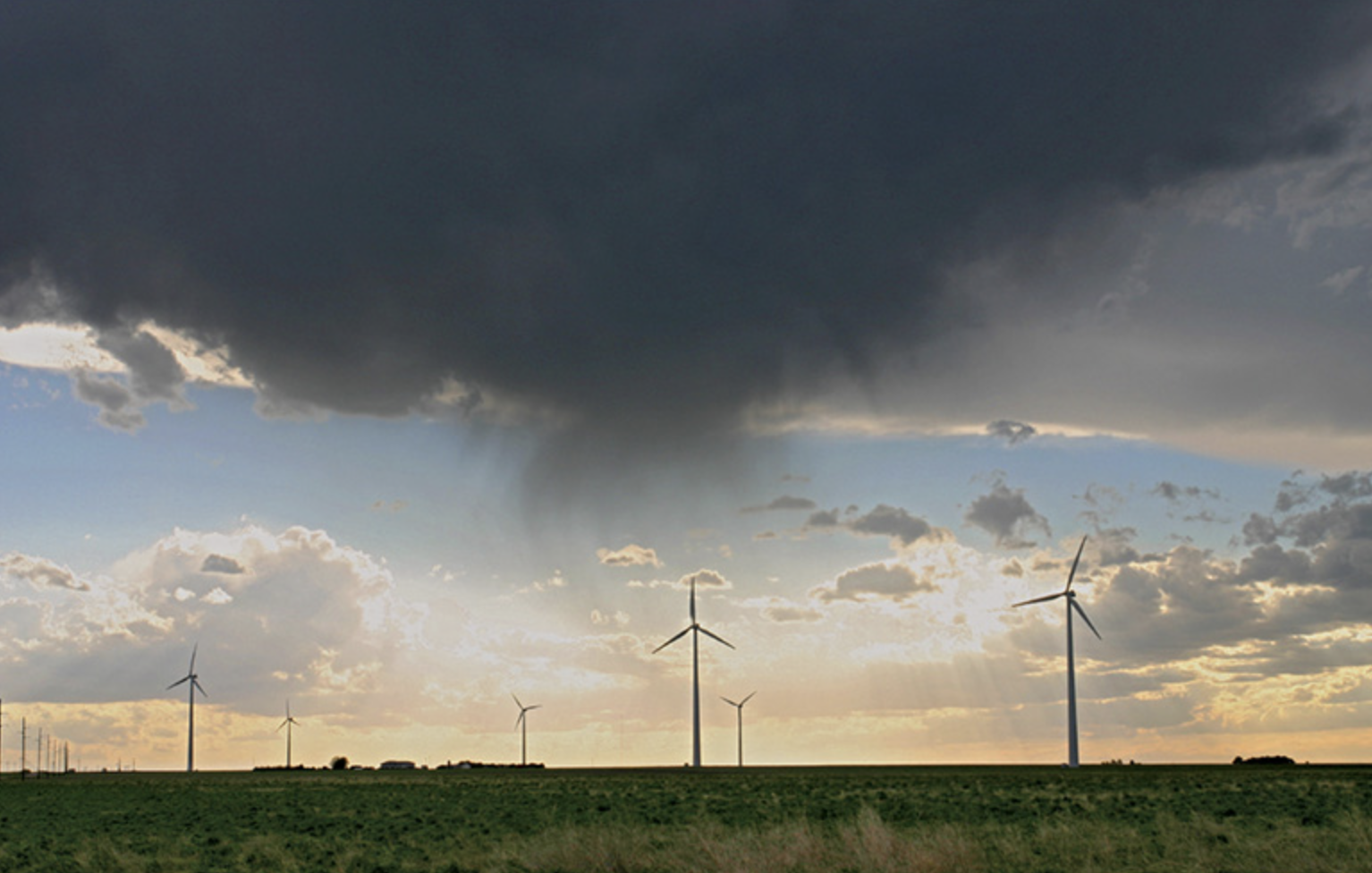
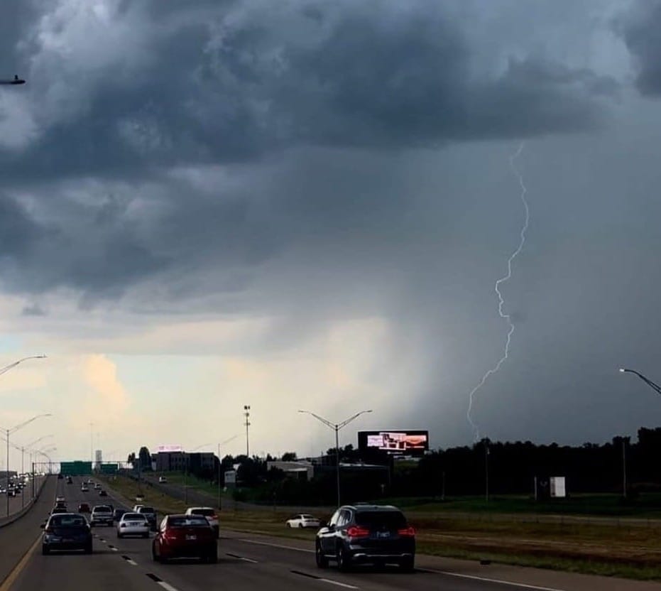
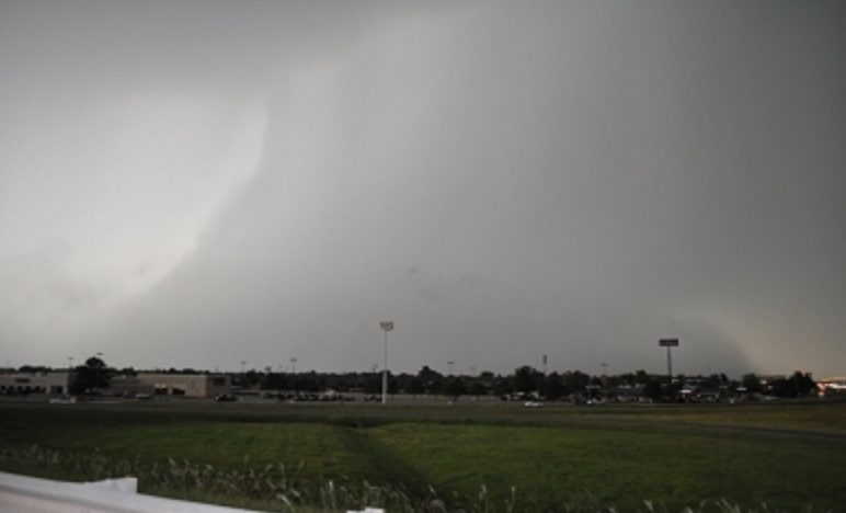
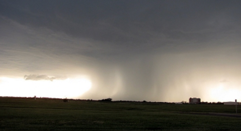
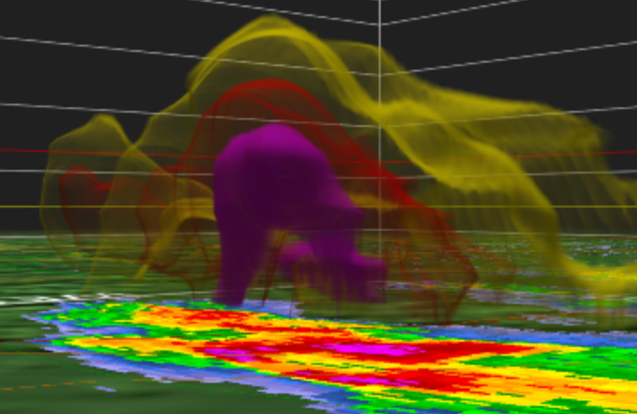
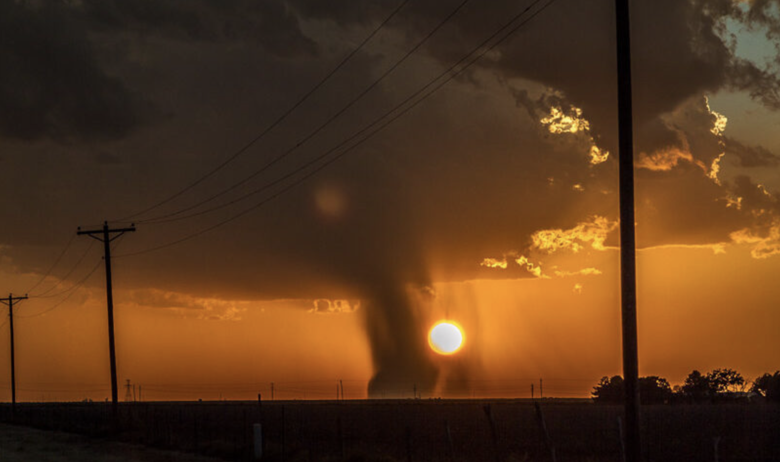
Downbursts look like something out of an AI simulation, but they’re real, and they hit with explosive force, unleashing powerful winds and torrential rain.
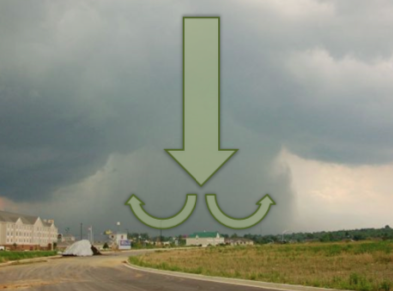
"Downbursts are strong, damaging winds at the surface with cold air that sinks throughout a thunderstorm, pushing out in all directions." said Meteorologist Charles Kuster.
You’ve probably experienced a downburst without realizing it–sudden gusts of strong, intense wind and curtains of rain during a pop-up, summer thunderstorm.
Charles Kuster, a meteorologist with the National Weather Service, has dedicated his career to understanding downbursts and how to better forecast them.
After graduating from the Meteorology program at the University of Oklahoma, Kuster was hired at the University of Oklahoma's Cooperative Institute (CIWRO) and, years later, transitioned to the National Severe Storms Laboratory (NSSL), where he currently resides in Norman, OK. With his firsthand weather experience and years studying at some of the best facilities in the world and the brightest minds in meteorology, he worked alongside NWS scientists to better understand downburst forecasting. His research has revolutionized weather forecasting with the help of radar technology.
Where Real Science Met 'Twisters' the Movie
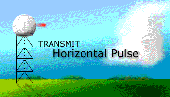
If you're familiar with the movie, Twisters, then you probably recognize the reference to 'Storm PAR'.
'Storm PAR' from the movie Twisters stands for Phased Array Radar
The weather radar that's used in real life—and with detecting downbursts—is also cleverly weaved into Twisters. Storm PAR's acronym stands for "Phased Array Radar", which is true in real life, too.
"This acronym actually stands for the same radar that's used in real-life." said Meteorologist Taylor Cox.
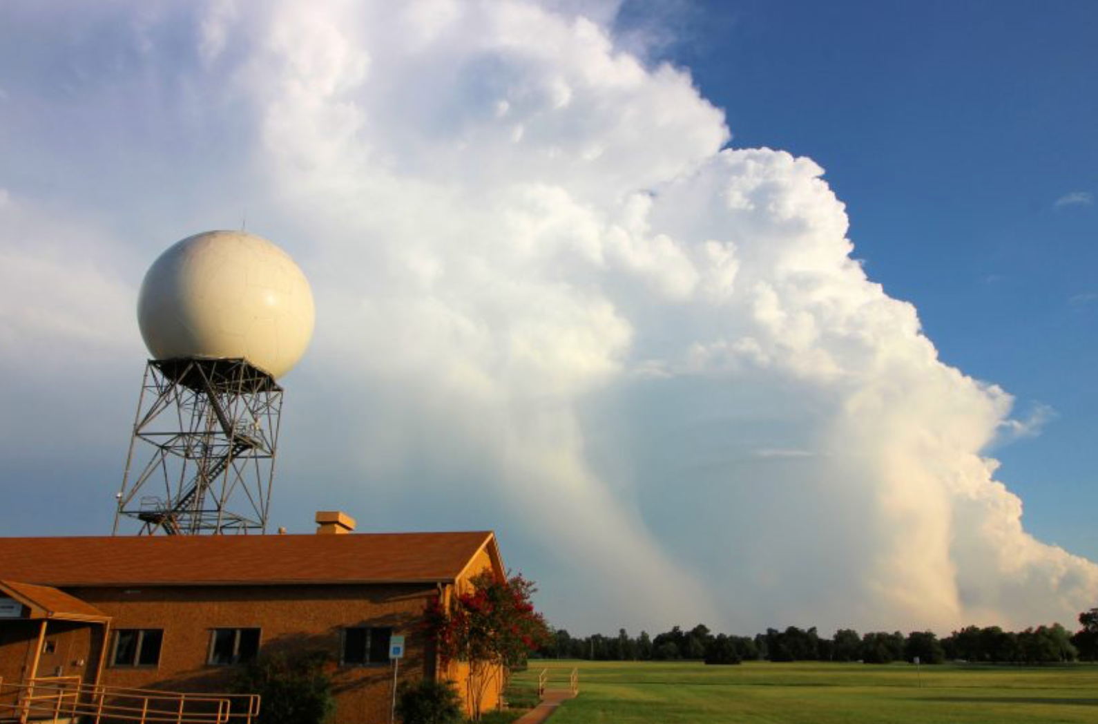
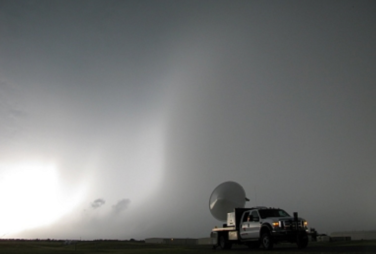
You might recognize these radars if you live in Oklahoma or surrounding areas. Oftentimes they appear as a giant ball on a stand.
A notable signature that was displayed by this radar was the downburst event in Norman, OK, in 2011.
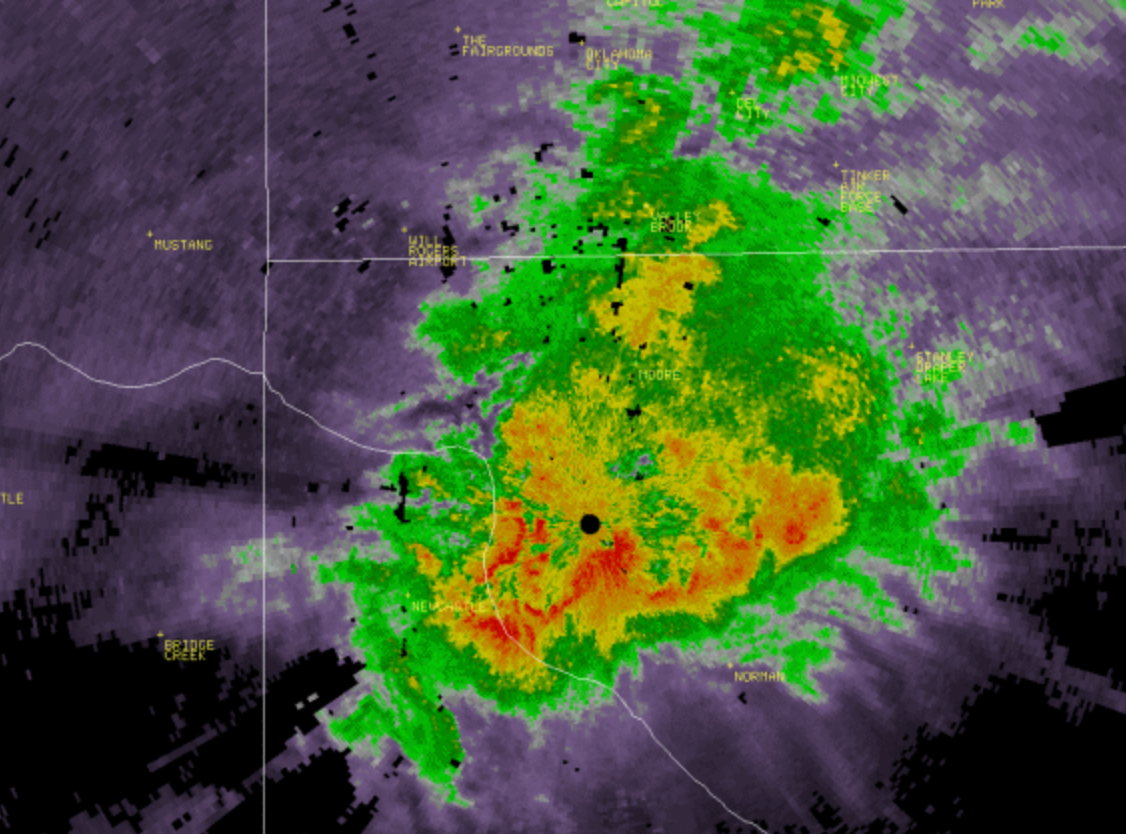
Massive Downburst Hits Norman, OK in 2011
On June 14, 2011, a series of powerful downbursts swept through Norman, Oklahoma, bringing significant wind and hail damage.
Kuster—having done his research on these storms for about 13 years—walks us through it.
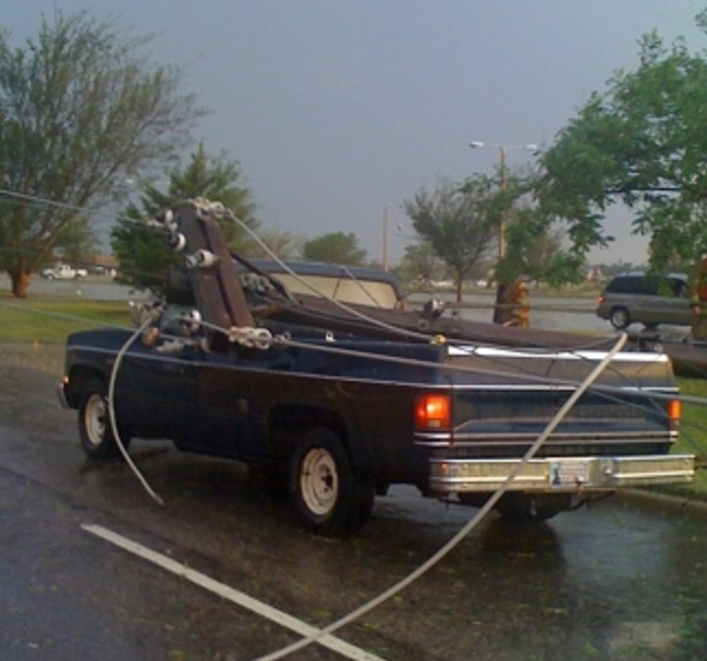
Wind speeds reached up to 82 mph, toppling power lines and tree branches near the University of Oklahoma. Golf ball-sized hail, driven by 70 mph winds, battered the area and caused widespread roof and shingle damage across the community.
“If you were in Norman, you probably saw the big ‘rain bomb,’ and the University of Oklahoma likely felt those strong winds too.” said Kuster
The Science Behind Downbursts
Kuster says he's studied lots of different downbursts across the country and in recent research findings, he's looked at 89 downburst events.
Many of these downbursts come from smaller, popcorn thunderstorms in the Southeast that are especially hard to predict.
"You can have 85 mph winds in Austin, Texas, or 75 mph winds near Wayne, Oklahoma, and most people never even hear about them.” said Kuster
Downburst research has come so far since the early days of radar technology.
Downburst Radar Detection Evolves to Mitigate Plane Crashes
In the 1960s and 70s, radars were no were near where they are at present. Pilots didn't know the dangers of downbursts, which unfortunately led to tragic plane crashes.
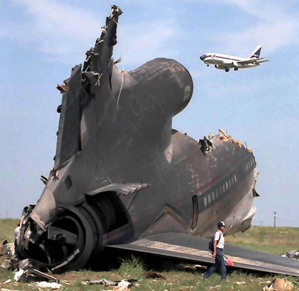
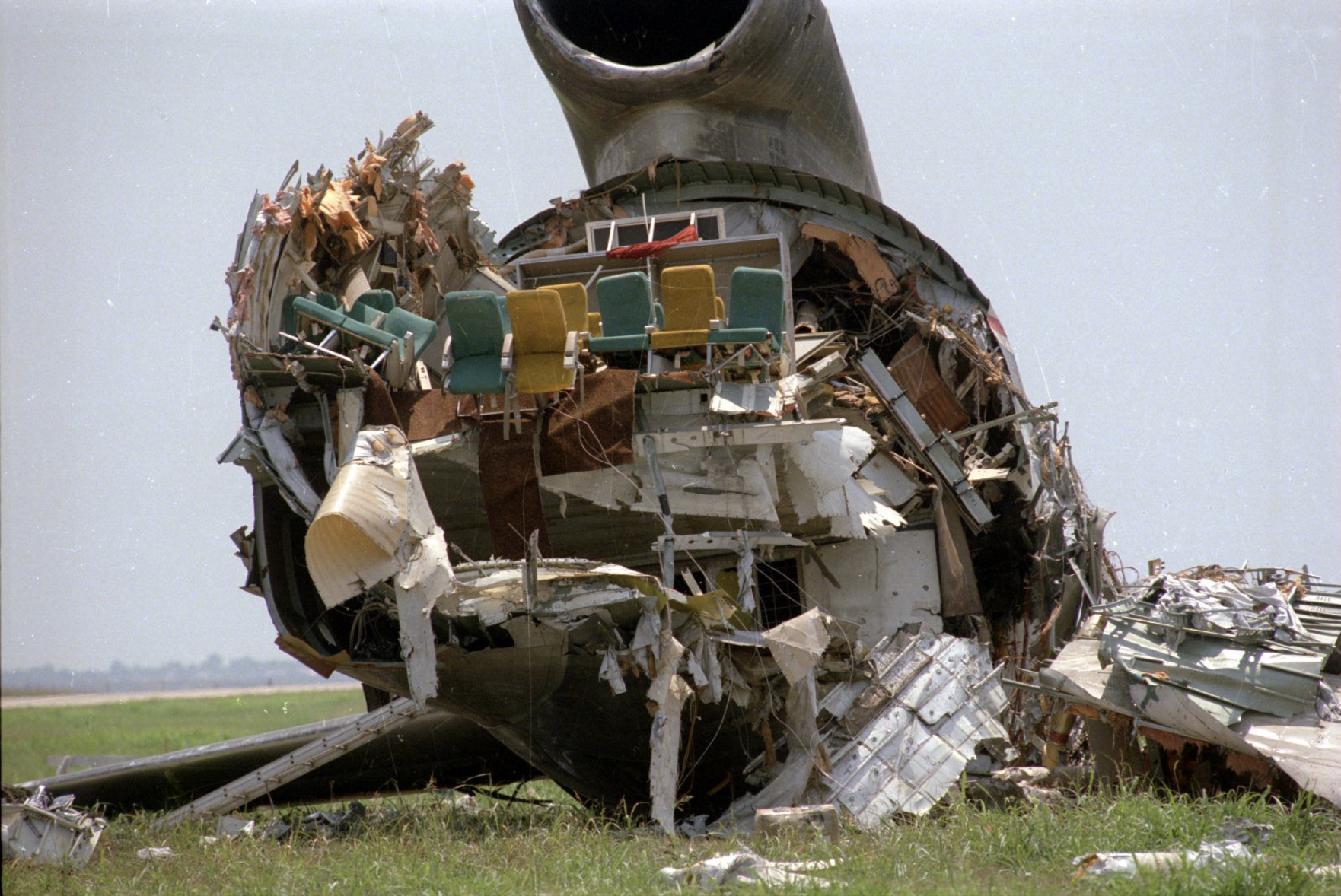
Delta 191-August 2nd, 1985. Credit: NWS Dallas Morning News.
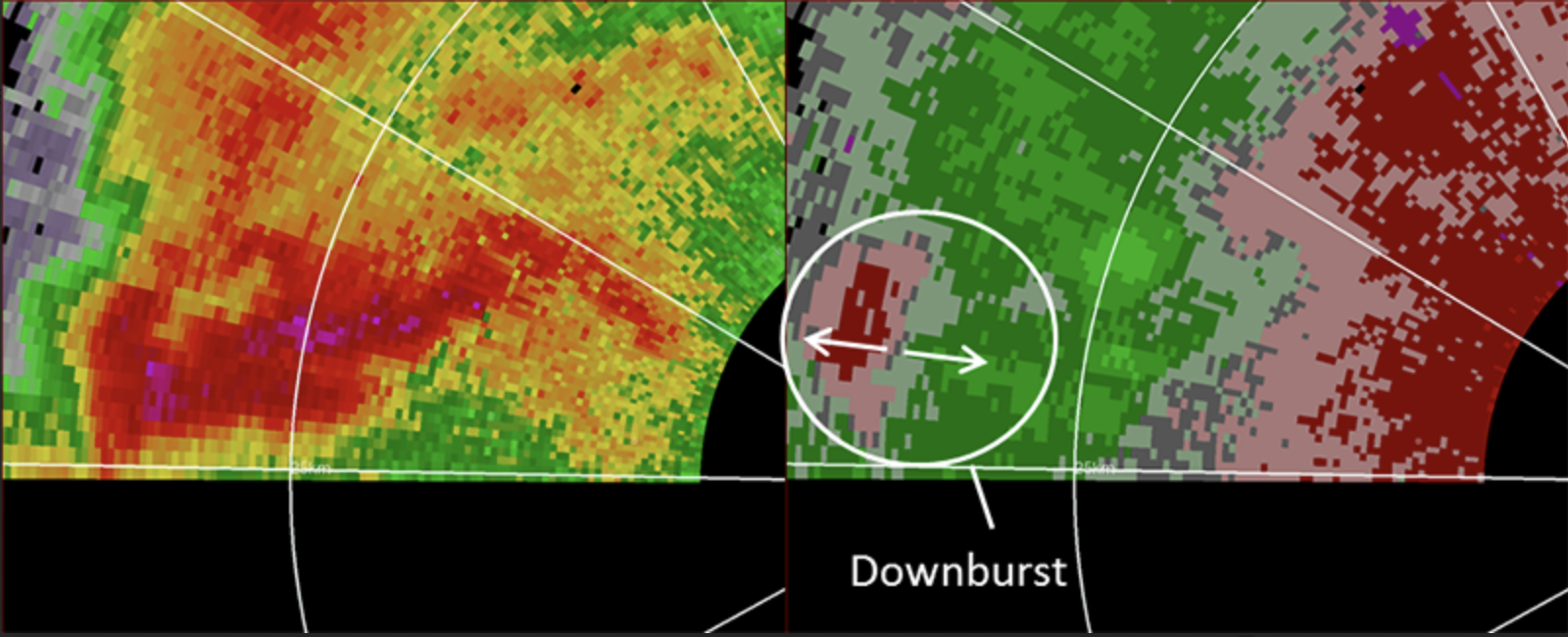
Now, with current dual-polarization radars, meteorologists can distinguish between rain, hail and other precipitation types.
"Dual-polarization allows you to identify ingredients that make downbursts stronger: heavy rain, pelting hail and rapidly sinking, cold air." said Kuster.
Most airports in the US now have radars nearby called terminal doppler radars—they help detect the changing winds occurring with a downburst system.
"You basically have a big, bright green, yellow and red blob on the radar signifying the downburst. That's how we know." said Kuster.
Modern downburst detection technology significantly reduces the risk of catastrophic plane crashes. Thanks to these advanced systems, there have been no aircraft accidents in recent years caused by downbursts.
The Future of Downburst Research
Kuster's goal is to focus on communicating his research and working with forecasters to figure out how he can best use the research in warning decisions.
"We’re looking at how to best visualize these radar signatures so that forecasters can have quick and easy ways to issue warnings."
Kuster aims to go operational with his research, building confidence in these future warning decisions to save lives and prepare those in the path of a downburst.
HailTrace meteorologists map high wind events like downbursts. Check out our wind maps and the products we offer, visit our website hailtrace.com.