Hurricane Erin: Surprise Category 5!
Latest storm track and maps... Hurricane Erin rapidly intensified overnight Friday to a Category 5 hurricane. This is faster and stronger than meteorologists forecasted, surprising many early Saturday morning.

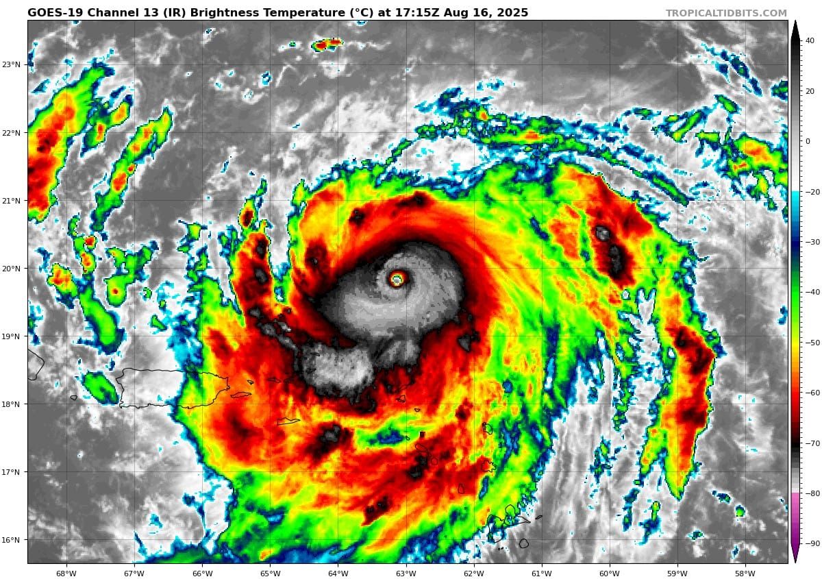
Hurricane Erin rapidly intensified overnight Friday to a Category 5 hurricane. This is faster and stronger than meteorologists forecasted, surprising many early Saturday morning. The storm is likely to sustain its rare intensity through the end of the weekend.

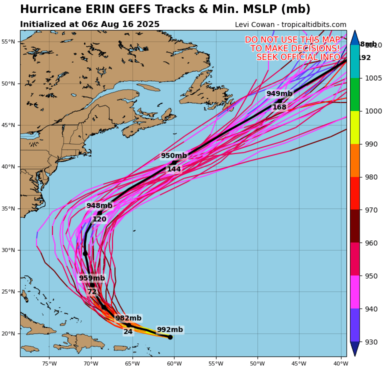
Where is Erin Going?
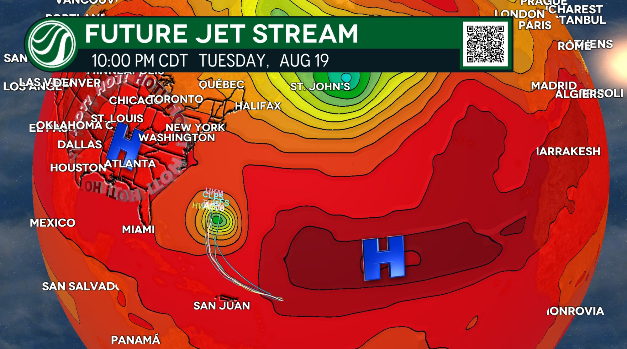
While the storm's track is nearing closer to the US, it has a very low chance of making landfall in the US.
An area of high pressure, stuck across the Lower Mississippi Valley, is pushing Erin out east, away from the East Coast. This same area of high pressure is trapping in heat for many across the US today, making it one of the hottest weekends of the year.
Heavy rainfall is likely at times across the Leeward Islands and Puerto Rico on Sunday. Flash flooding and landslides will be the biggest concerns. For the East Coast, Erin is likely to produce life-threatening surf and rip currents this week.
HOW RARE ARE CATEGORY 5 HURRICANES?
Most Atlantic Hurricane Seasons will pass with no Cat 5 Hurricanes. These rare monster storms usually only happen about 6 times for every 100 named storms.
Still, Erin's story may sound familiar. Hurricane Beryl was the first hurricane in the 2024 season, also rapidly intensifying to Category 5 strength. Those two commonalities are about where the similarities end.

WE ARE JUST GETTING STARTED
On average, hurricane season will peak between mid-August and late September. HailTrace meteorologists are still forecasting a normal to above normal hurricane season.
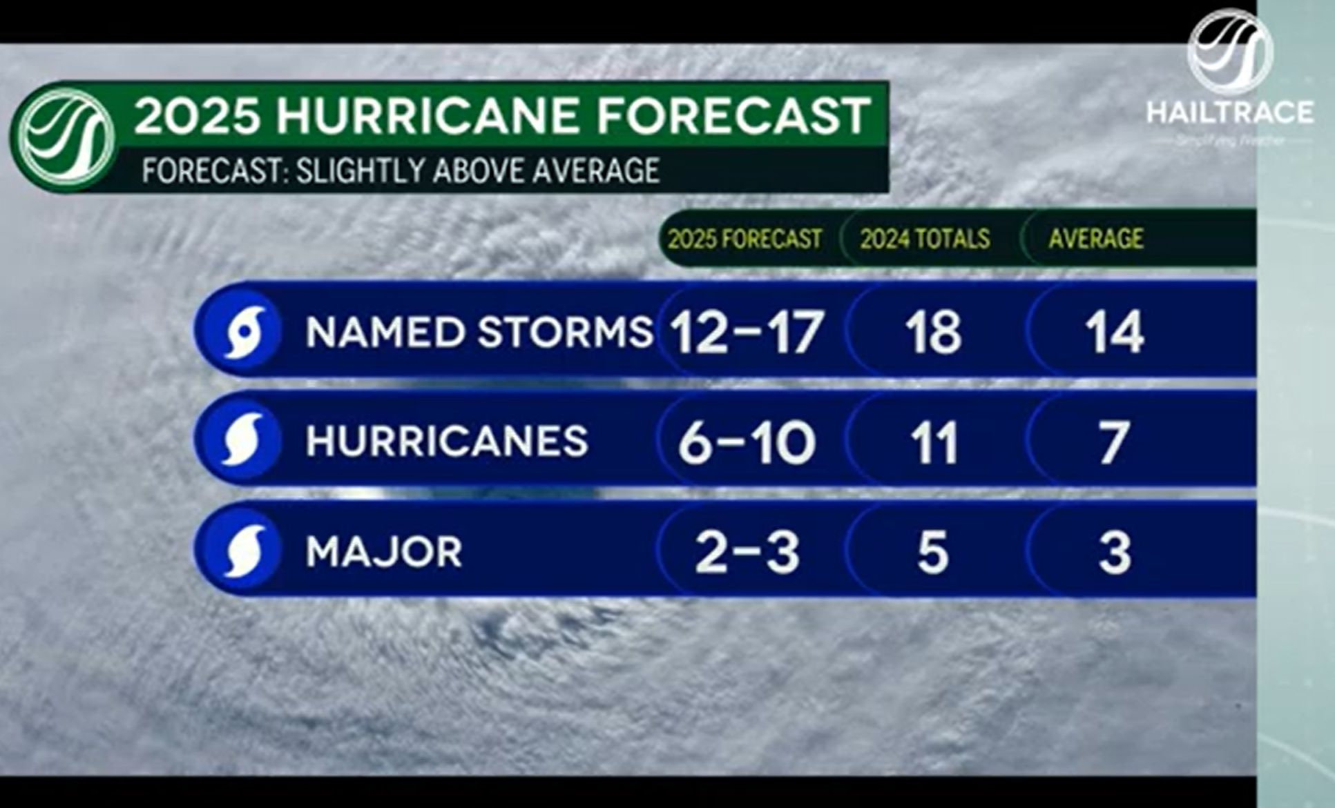
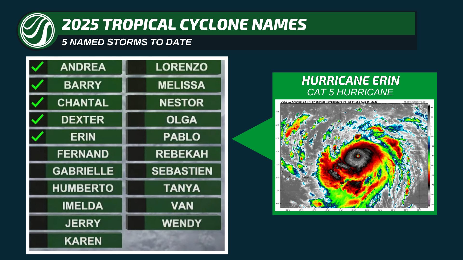
So far, we have had 5 named storms, and at a minimum, 7 more are expected. Next on the tap is Fernand. HailTrace meteorologists will be tracking it. Follow us for more weather updates.
HailTrace's team of meteorologists will be monitoring the tropics and tracking every storm that develops. For more information on HailTrace and the range of products we offer, visit our website HailTrace.com.