First Blizzard Warning: Over 13" of Snow in Louisiana
The National Weather Service issued the first-ever blizzard warning for the southeast Texas and southwest Louisiana region, as Winter Storm Enzo tracked eastward along the Gulf Coast.
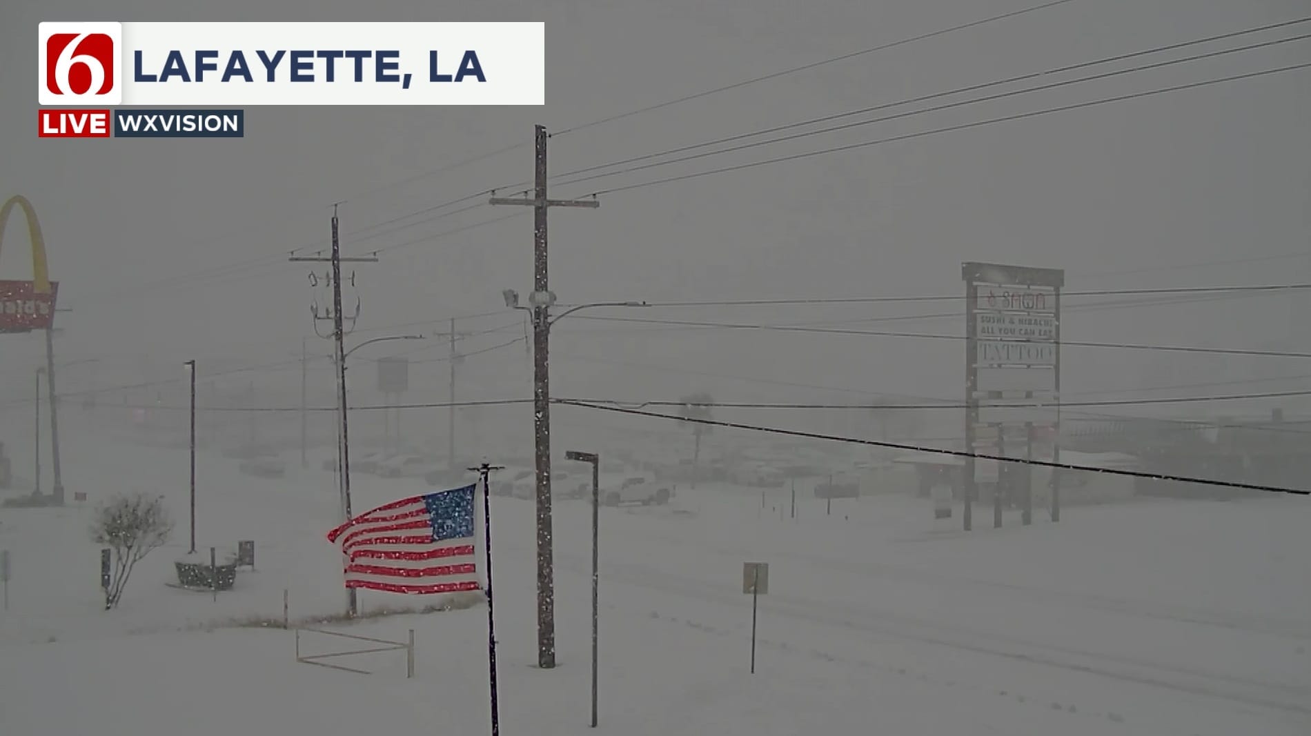
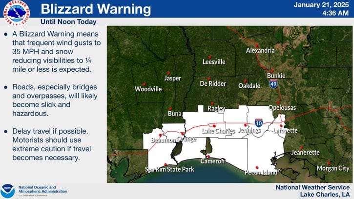
Shortly after 4 AM on Tuesday, January 21st, the National Weather Service issued a blizzard warning for a section of the Gulf Coast that included Beaumont and Port Arthur in Texas as well as Lake Charles and Lafayette in Louisiana. This was the first ever blizzard warning for the area, and it addressed the ongoing hazards that Winter Storm Enzo has brought to the South and Southeast, as part of a larger surge of Arctic air into the continental US.
Arctic Blast Boosted Snowfall Potential
Following this past weekend's outbreak of cold air across the nation, temperatures across southeastern Texas and southwestern Louisiana dropped to about 20 degrees below normal. These sub-freezing temperatures spread all along the Gulf Coast, priming the environment for snow generation on Tuesday and Wednesday.
As Winter Storm Enzo tracked eastward along the coastline, the storm pulled moist air in from the Gulf and lofted it high into the atmosphere, producing a rare heavy snowfall event for the region.
Enzo's Snow Totals Surge into Second Place
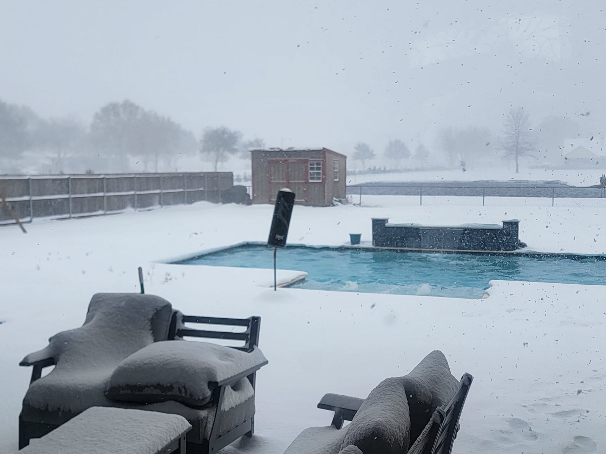
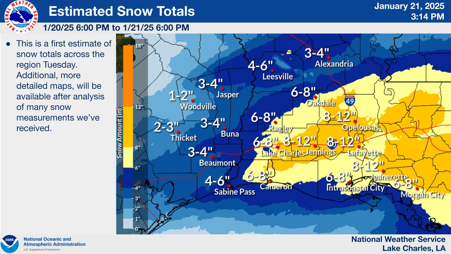
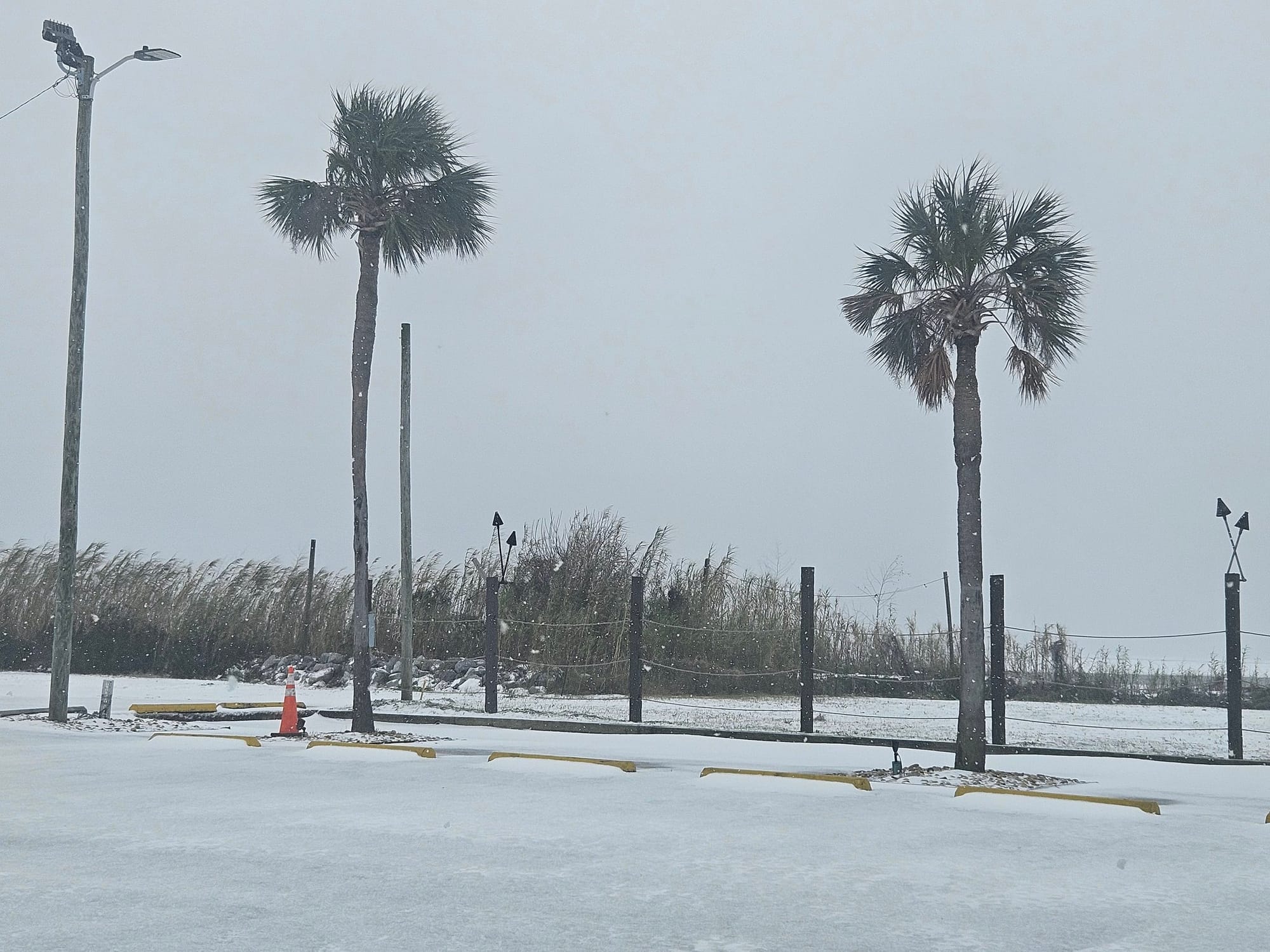
Snowfall reports from the Lake Charles, LA, area show snow depths of up to 6 to 8 inches as of Wednesday afternoon, while images on social media suggest locally higher totals (see below).
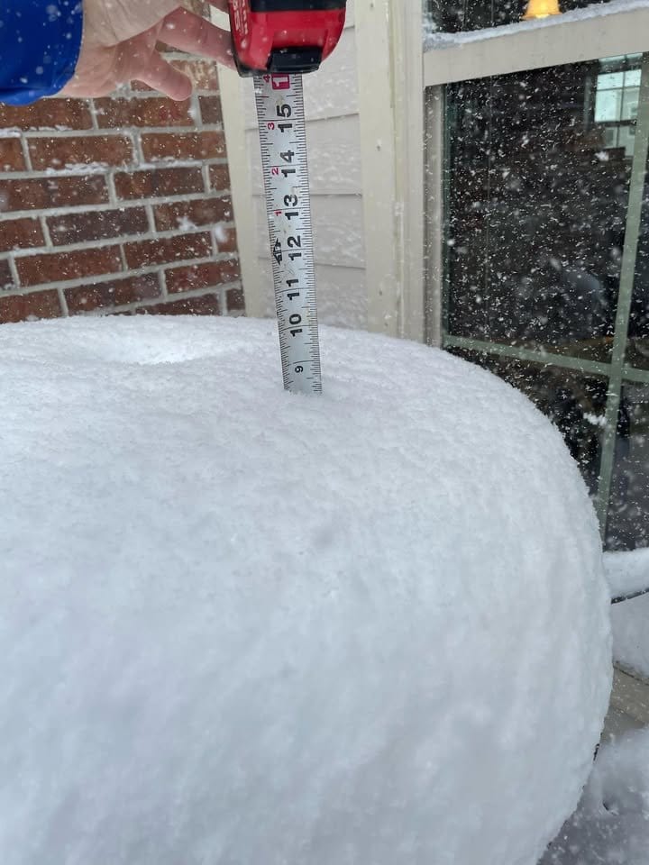
In the Lafayette, LA, area, reported totals exceeded 13 inches, as of Thursday morning, while Beaumont and Port Arthur, TX, reported values from 4 to 8 inches.
After all snowfall totals are finalized, the January 20th-22nd, 2025, winter storm is likely to cement itself as the second-highest measurable snow event for the region since 1895, beating out the February 12th-13th, 1960, snow event that produced 4 to 5 inches of snow. Furthermore, although Beaumont, Port Arthur, and Lake Charles are unlikely to break the all-time record, snowfall totals in Lafayette, LA, may come close to the previous record of 14 inches, set on February 14th-15th, 1895.
More Snow in Store for the Southeast
Winter Storm Enzo continued along the Gulf Coast and into Florida through Wednesday, bringing more snowfall to typically mild and sunny areas. Although no further blizzard conditions occurred as the storm progressed eastward, Enzo produced snow all the way up to the Virginia Beach area, with reported totals of up to 10 inches of snow in the Pensacola, FL, area.
Near blizzard conditions happening at the New Orleans Lakefront pic.twitter.com/009t8oMDHP
— Zack Fradella (@ZackFradellaWx) January 21, 2025
Video of snowfall in New Orleans, LA, on Tuesday morning (Courtesy: Zack Fradella).
Looking Ahead to Spring
The winter of 2025 will certainly be remembered for the widespread snow Enzo brought to the Southeast. And as temperatures around the Gulf Coast eventually warm back toward climatological normal, we will once again see the threat of severe weather throughout the region.
At HailTrace, our team of expert meteorologists specialize in identifying weather hazards across the nation, with the aim of supporting those in the restoration industry through real-time hail, wind, and tornado maps.
You can find HailTrace's range of hail, wind, and tornado maps on our website, HailTrace.com.
To read more about the variety of tools HailTrace offers, check out our blog post on our 4 types of weather reports.

